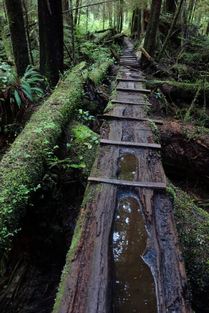
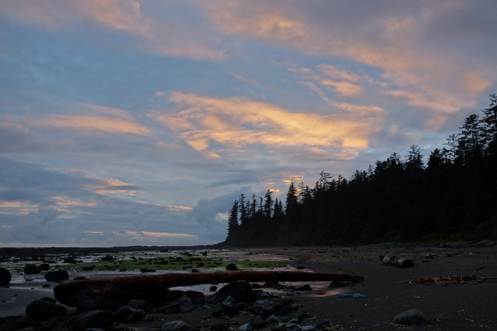
Vancouver Island’s West Coast Trail is a 75 km-long rugged coastal route through mud bogs, over slippery boulders, under huge fallen trees, up 70 ladders, across 130 bridges, and zipping over rivers inside 4 cable cars. I hiked the trail in May, when it’s especially wet and muddy.
Day 1 (May 29, 2013)
Bamfield (Pachena Bay ranger station) to Tsocowis Creek Campground
Distance walked: 16 km
Wildlife seen: ravens, 2 black bears, hundreds of smelly seals
Hikers encountered (going opposite way as me): 7 (of these, 5 had just finished the trail)
Hikers encountered (going same way as me): 4
Lunch: fresh avocados with pork jerky, cashews, and chocolate
I wake up at 5:15am in my 6×10 foot hostel room. It’s a private room, but in a solitary-confinement sense. I eat half a dozen bananas then I’m out the door. It’s raining. Hard. I hide under the umbrella I plan to use on the trail. This 15 minute walk to the bus station is the only time I’ll use it for the entire trek, save 5 minutes under a big tree with pounding rain smashing through the upper leaves.
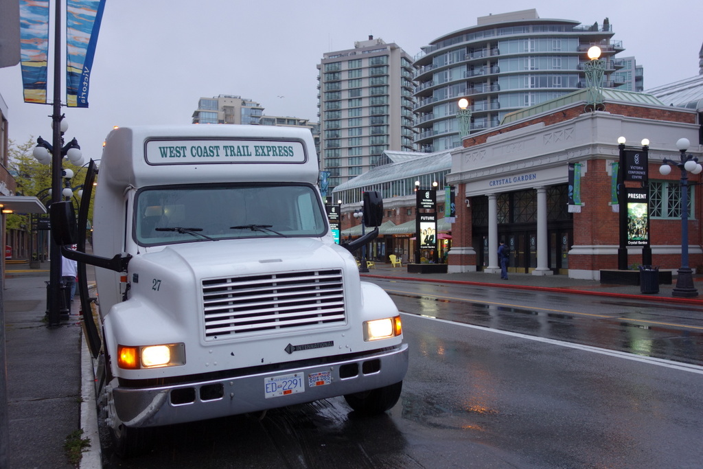
The bus departs at 6am sharp. All the windows are fogged over but I continuously wipe them down to reveal the sharp lights of downtown Victoria passing by, then soggy suburbs, then deep green forest. After two hours we stop at Port Renfrew. This is the southern end of the trail. Everyone I meet tells me this is where you should start so that you get the most arduous hiking out of the way first. One hiker, a Dutch expat working as a baggage handler at the Vancouver Airport, departs. I continue for another 4 hours to Bamfield.

There’s a half-hour orientation at the ranger station. The young ranger explains how to read tide tables and the danger of getting trapped on the beach. If you get your timing wrong you can find yourself stuck between an impassable headland and the high-tide now blocking the way you came. If you’re lucky you can just shiver in the rain for six hours. If you’re unlucky you’ll get swept into the ocean while trying to cross a surge channel, as has happened to numerous hikers.
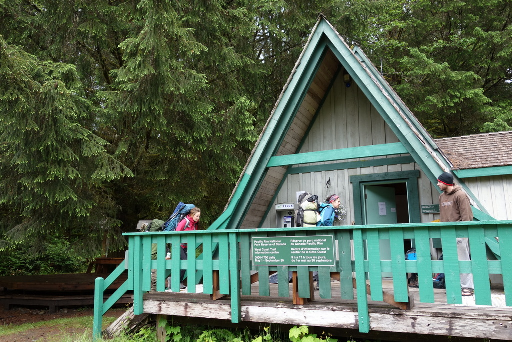
The orientation finishes and I come back outside, excited to start the journey. With me, there’s a young couple from the Netherlands and a Polish girl hiking solo. We’d all left our backpacks outside during the orientation. Big mistake. I find my food bag ripped into and my dinner, Southwestern Couscous, strewn across the grass. A pair of jet-black ravens cackle from a nearby tree. Fortunately, that’s all they got. But lesson learned. I put everything back in order and eat a few quick snacks then don my pack and head down the trail to the beach.
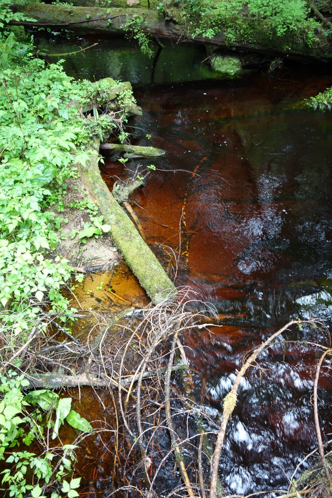
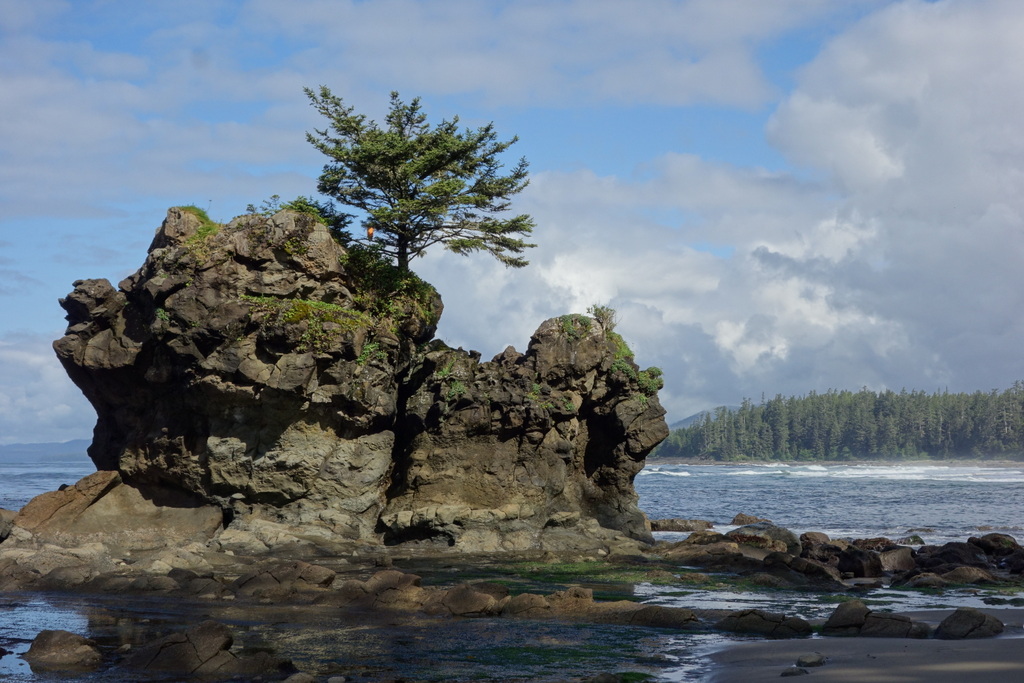
It’s immediately beautiful. Waves crash into the soft sandy shore. Birds dart through the dense forest, singing to their mates. There’s a pungent aroma of salt and seaweed. The couple have stopped at a creek at the far end of the beach to filter water. It’s a deep brown, almost the colour of beer. They load up on as much water as they can carry. They already have 60 lbs packs. I skip the creek. I have no water at all and I carry no more than half a liter for the entire trip. There’s water everywhere. Every 10 minutes you cross a rushing creek. When it rains, as it does almost constantly, the path itself becomes a stream.
But I’ve lucked out. The rain has stopped and it’s now quite calm. Heavy clouds drift past overhead but mercifully hold back. I catch up to the solo hiker. We walk together for a while, carefully following each other’s steps around mud puddles covering the trail. We take a picture for each other, then I continue on at the quick pace I find comfortable when I’m carrying a light pack.
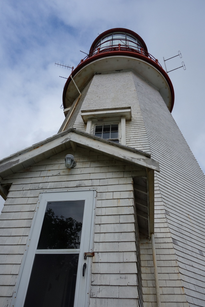
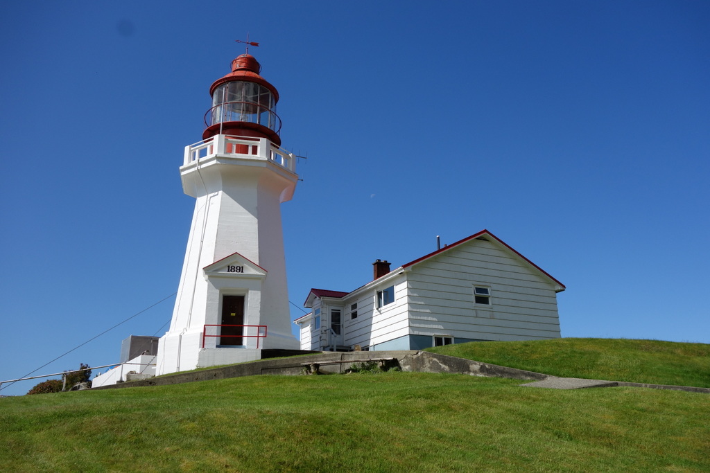
An hour later I come to a sign pointing off the trail to Pachena Point. A short side-trail winds through the dense forest to a beautifully sculpted lawn. There is a vegetable garden in front of a house that looks like it was last updated in the late ’50s. This is the home of the lighthouse caretakers. The lighthouse itself is very cute. The white tower with red lantern stand in contrast to the deep blue ocean and crashing surf in the distance. I drink a little water from the tap.
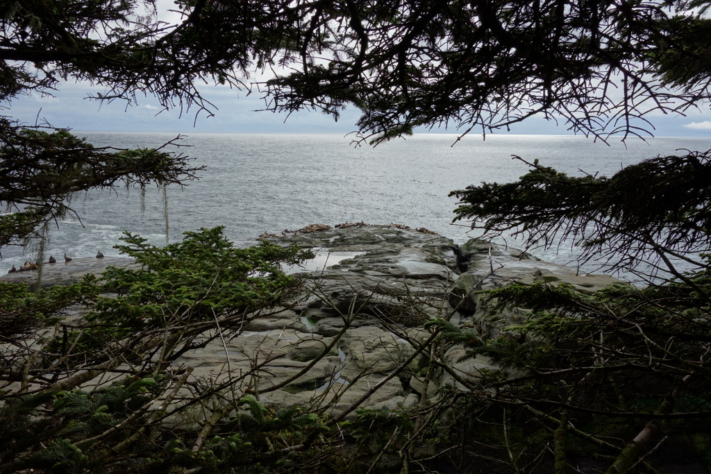
Another side-trail, this one more obscure and questionable looking, branches off a short while later. I follow it to a rocky outcrop dropping precipitously into the ocean. A large rock emerges from the waves and I spot what I’d already suspected from the acrid smell wafting toward me. Seals. Hundreds of them. It’s an amazing sight. I hope the three fellow hikers I started out with take these detours too. But I never meet up with them again.
Day 2
Tsocowis Creek to Cribs Creek
Distance walked: 25.5 km
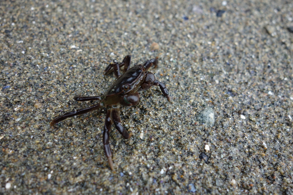
Wildlife seen: tons of little crabs, frogs, eagles
Hikers encountered (going opposite way as me): 9
Hikers encountered (going same way as me): 8
Lunch: fresh bbq salmon and a baked potato
I camped at Tsocowis Creek last night. There’s a small guardian cabin and a nice clearing in the forest offering protection from the rain. This would have been perfect for cooking dinner. If only I had dinner. Fortunately, despite the Southwestern Couscous being lost to ravenous ravens, I have lots of snacks left over from the bus ride. I wanted to make sure I started the trek on a full stomach but I completely overshot. Now I have lots of food. I finish the pork jerky that Charles gave me as a trail-gift. He thought about sneaking it into my pack but he was afraid I would find it before getting to Bamfield and eat the whole thing. He knows me too well.
Just before Tsocowis Creek I was enjoying a walk along the sandy beach when I saw two people in the distance frantically waving their arms. I slowed down, trying to understand what they were doing. It seemed strange. They were standing still, packs off, but shaking their arms rapidly. Suddenly I saw it — two black bears! I stopped immediately. Motionless. But the bears seemed completely unconcerned as they slowly meandered over logs and through bushes. In fact, they looked down-right soft and cuddly. Small too, perhaps yearlings. After a few minutes they disappeared into the forest without a sound.
|
|
|
|
|
|
I wake up to raindrops hitting the tent. It’s especially loud inside my nylon* cave, as if inside a drum. I’m excited to start the day, rain or shine. There’s so much to see and I’m hoping to spot more wildlife today. The rain dies out as I pack up and head down the trail.
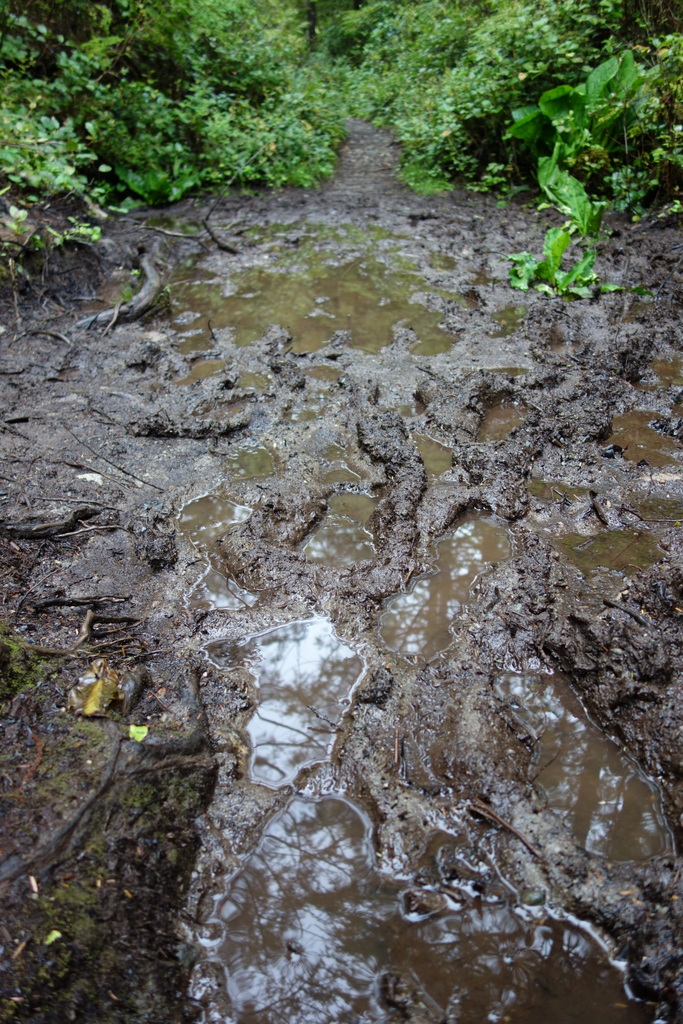
There is mud everywhere. Not just puddles but deep bogs filled with thick brown goop. At first I try to tiptoe through and around them, precariously balancing on slippery stones and tree roots. Finally, I slip — SPLASH! My left foot is completely soaked and covered in mud. At least it was only my foot. It could have just as easily been all of me lying in the muck. I pause for a moment, trying to stomp some of the water out, then realize the futility of trying to keep dry. Instead, I stop in front of the next mud-whole I come to. 1-2-3 — SPLASH! I jump in with both feet. I feel great. My shoes goosh with every step but I’m now completely sure-footed. My speed picks up and I just walk right through every muddy spot I find.
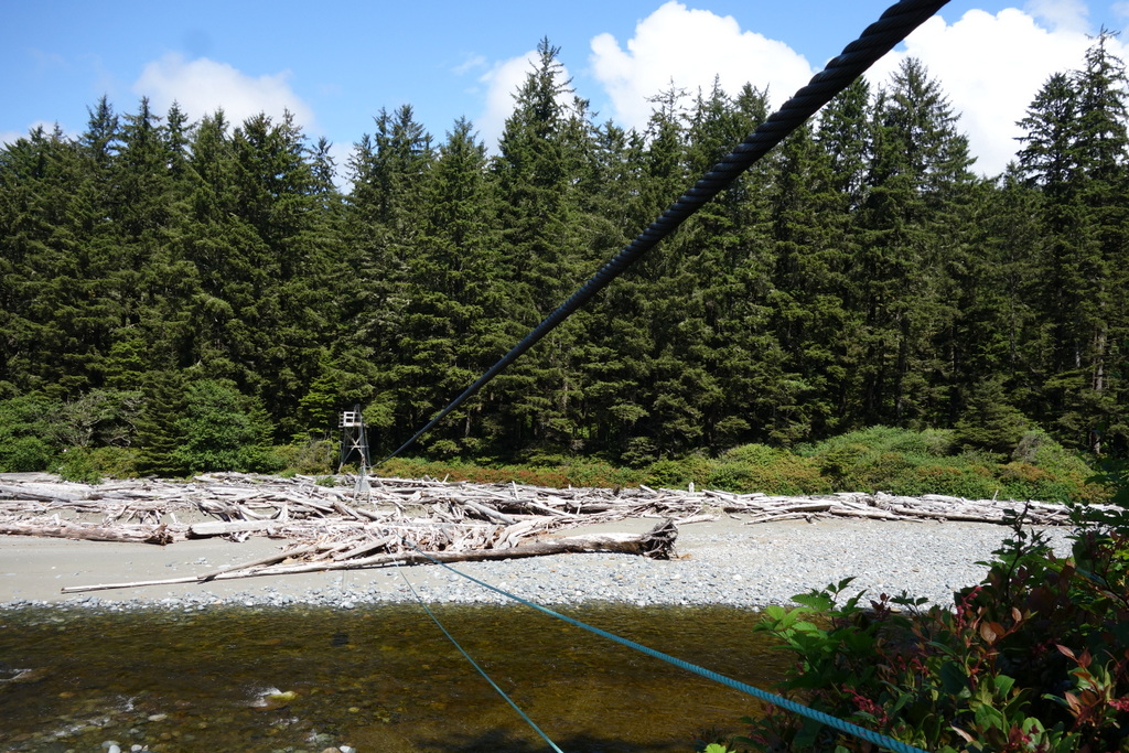
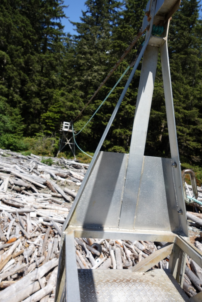
At Klanawa River I come to my first cable car. I’m really excited! The WCT is famous for its cable cars. These metal contraptions suspended high above the ground on a pulley system ferry hikers from one side of raging rivers to the other. I grab the rope and start pulling the cart toward my side of the river. It’s a good workout. After lots of walking, your arm muscles think they’re on holiday. No such luck on this trail. Carefully, I hold the cart in place while I step inside, bringing my pack and poles with me. I let go of the rope and — WHEEEEE — the cart flies down the rope. It’s just like a zipline, only you have to do all the work. The cart comes to a stop at the middle point of the river and from here I haul myself forward, pulling the other end of the rope. It’s a lot more work now, pulling not only the cart but my pack and my own body weight, and the closer you get to the end the harder it gets. Finally I make it, arms burning but exhilarated. This is great!
The rain starts again. It’s soft at first, just a drizzle. I like it. I meet a group of three Americans on the trail, heading the same direction as me. They all have huge packs and they plunge deeply into the mud with each misstep. I ask them how they’re doing. They respond “surviving”. Despite being from Seattle, the rain gets to them. “We get rain too, but we stay inside!” I kind of envy the epic journey they’re having. Kind of. They let me pass by and we wish each other well. I think that’s the last I’ll see of them. But I’m wrong.
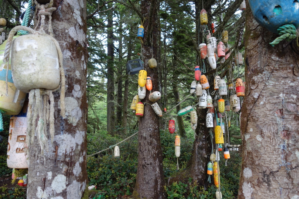
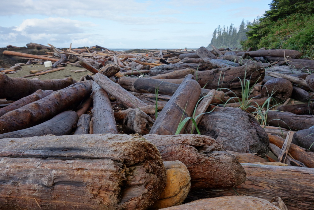
The rain intensifies. It’s coming down hard now and the wind is whipping it in my face. I’m on the rocky beach and there is no protection. I try my umbrella. The wind nearly turns it inside out and I put it away, content to push through the pelting water. A collection of brightly coloured buoys dangling from tree branches appears in the distance. This is how you find the forest trail on the WCT. You can’t miss them. And if you do, you’re in trouble. I scramble up over slippery sun-bleached logs and onto the trail. I don’t even notice that everything is mud. When there is a “dry” section of trail it’s inundated with rushing rainwater. It soaks my feet. Cold.
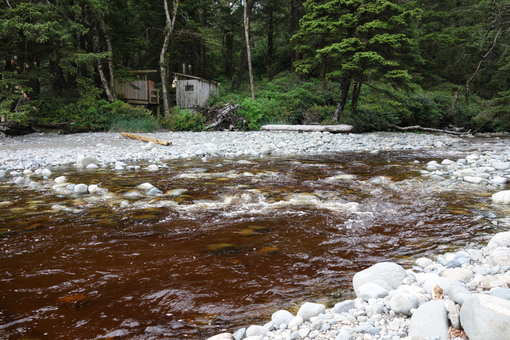
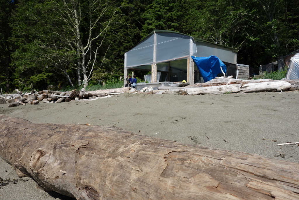
Nitinat Narrows is at km-32 but it feels like a psychological half-way point. Doug, a rugged local, takes you across the outlet in his fishing boat. He’s fast too. I wait for no more than a few minutes then he zips me across. As we pull into the dock he tells me all the wonderful things I can buy in his little shack. Soda, beer, chocolate bars, snacks. And salmon. Freshly caught, lovingly barbecued salmon. I can’t resist the salmon. And the steaming hot wood stove doesn’t hurt either.
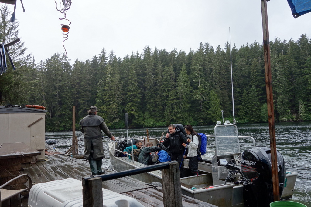
I’m enjoying my delicious meal when Doug speeds off to collect some hikers from the other side. It turns out to be the three guys from Seattle. They’re soaked. And tired. But they’ve caught up to me and their eyes light up when they see the warm dry shack and steaming hot food. I make room beside the stove which has almost completely dried me out. They’re on their third day and hope to be done in another three. They heard about the trail from some buddies and decided why not give it a shot?
I finish my meal and head off. The rain has stopped and everything smells so fresh and wonderful. There is pine and fir in the air and every once in a while you catch the scent of the sea in the breeze. I walk for a few hours, then find a nice spot to camp on the beach beside a creek. The views are gorgeous. Waves violently crash into rock outcroppings sending foamy surf flying into the air. It’s still nice and I relax as I cook dinner and watch the sunset. It’s dark now and the wind is picking up again. I sense rain coming so I get ready for bed. As I’m getting into my tent I see a flicker of headlamps at the far end of the beach. As they get closer I see it’s the American guys. The rain starts to crash down just as I tuck into my warm sleeping bag.
Day 3
Cribs Creek to Camper Bay
Distance walked: 20.5 km
Wildlife seen: all kinds of birds, more little crabs & stinky seals
Hikers encountered (going opposite way as me): 9
Hikers encountered (going same way as me): 8
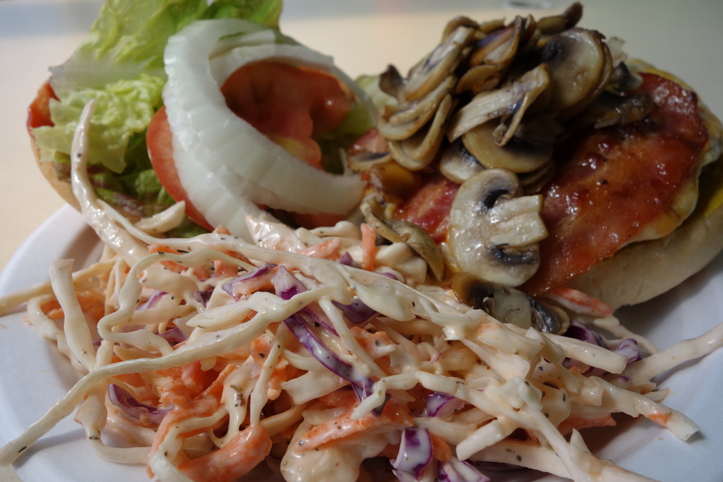
Lunch: a big burger with mushrooms, cheese, bacon, tomato, lettuce, onion, and coleslaw
Bright sunshine awakens me. At some point in the night the rain passed by and it’s now a beautifully sunny morning. I’ve slept in, happy to have a relaxing morning, but when I see how crisp and bright it is, I pack up quickly. Everyone else is already up. Their tents and clothes are spread over rocks, drying in the sun. I chat with the American guys who found a nice spot to camp on the beach despite the darkness and rain. They’re feeling sore today. Blisters. And they’ve been pushing hard. They’ve only given themselves six days to finish a trail that usually takes seven to eight. And they have monster packs.
I grab some water from the creek and head off. I’m using chlorine dioxide to treat the brown turbid water and I need to wait 10 minutes for the mix to be ready. A creek gushes out of the forest onto the soft sandy beach, carving ever-changing trenches. The water is refreshingly cold and clear. The sun beats down and I’m hot and thirsty. It’s been half an hour now but for some reason I forget if I’ve already treated the water in my bottle. I must have – I always do. So I drink it down and refill from the creek. Then it hits me. No, I didn’t treat that water. I just drank half a liter of who knows what? Giardia? E-coli? Cryptosporidium? Dumb mistake. I’m worried. But there’s nothing I can do now.
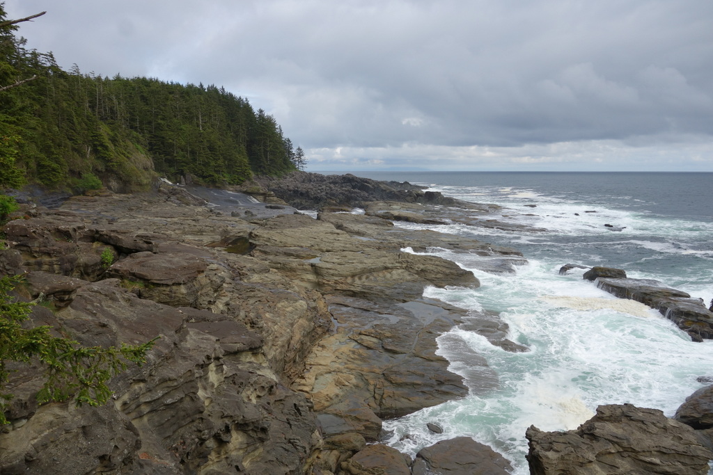
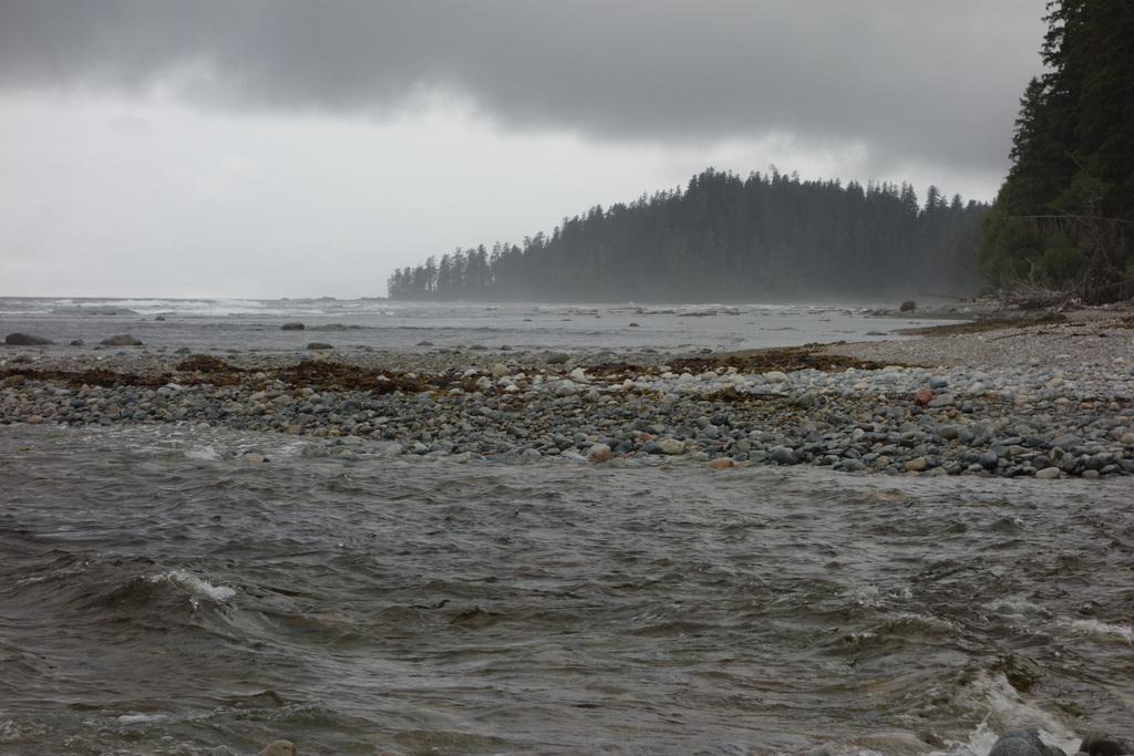
My shoes sink into the sand as I walk. You think that the beach will be easy after all that tromping through thick mud in the forest. But it’s not. Now that the sand is dry, it’s soft, and it no longer supports my footsteps. I leave behind deep depressions and feel like I’m pushing through heavy snow. It’s low tide, revealing a long stretch of flat ocean shelf. It’s smooth rock, covered in sea weed and barnacles. Steam drifts up from shallow pools of water, carrying with it fragrances of kelp and sea grass. Then an idea comes to me. My feet have been wet every moment up till this morning. What’s a little more water going to hurt? I step onto the flat rock and it’s wonderfully solid. And grippy. I move quickly, I could almost run. But I go carefully. There’s a lot of life in the inter-tidal zone and little crabs rear up at me as they sense me coming close. Some jump upright and point their pinchers at me. Others scurry away and hide under rocks. I cautiously step around all of them.
The beach comes to an end at an imposing headland, waves crashing into the weather-worn rock. I climb up a long ladder and out onto a clearing. Here, at Carmanah Point, I visit the second lighthouse on the trail. In 1896, lighthouse keeper Phil Daykin rescued nine people in a shipwreck and the lighthouse remained a refuge for survivors for many years. In fact, the WCT was built in 1907 along the route of a telegraph line to facilitate the rescue of survivors of shipwrecks along the coast. Shipwrecks are now rare but the lighthouse is still staffed and I meet Janet who takes a break from her morning weather report to point out some tricky spots on the trail ahead. It’s such a beautiful day and the views so great that it’s hard not to linger here all day. But I can’t wait for my next destination!
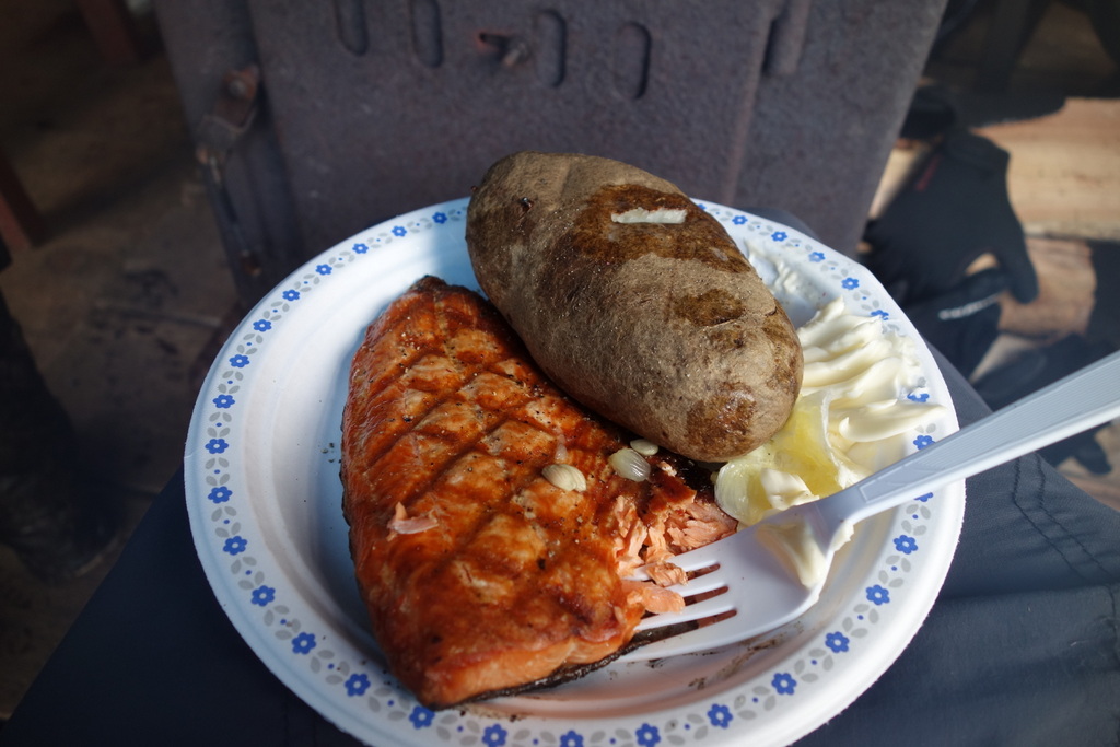
Back on the beach I spot a small red buoy suspended from a tree branch and scramble up the rocky hillside. This is the marker Janet told me to look out for. Continuing around the obvious looking bluff puts you on the edge of crumbling cliff with angry waves crashing in below. Scrambling up over the hill is much safer and puts you right where I had been hoping to end up – Chez Monique’s. Chez Monique’s is famous on the trail. Everyone you talk to raves about this little shack on the beach. It’s not the candy bars or chips or any other kind of junk food you can buy here. It’s about the BURGERS! Big juicy burgers piled with cheese and fatty bacon, fried mushrooms, tomato, lettuce, onion…! Pretty amazing considering this is in the middle of a 75 km rugged coastal trail. Mat, a portly middle-age man from Edmonton, fires up the stove and starts working on my burger. He’s working here for the summer. I sit down and chat with Monique herself. She’s 72 and still loving life in this remote camp. She tells me about her time as a computer programmer back in the days of punch-cards and the unlikely twist that brought her here. A speck of a boat appears out on the ocean and Monique yells in her French-Canadian accent, “that’s my husband!” “I can always tell it’s him. I can just sense him… Too many years together.” She laughs. Her husband is taking clients to a nearby fishing spot, one of the best in the area, she tells me. My burger is ready and even though it’s only 10am I’m starving! To be honest, anywhere else it would be a 3-star burger but here, after tromping through 45 km of knee-deep mud and racing tides to escape being trapped on some rocky outcropping, it’s a 5-star burger. I devour it.
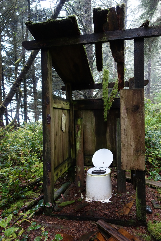
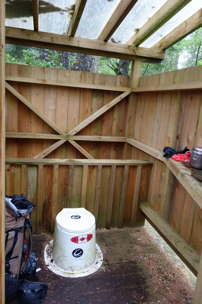
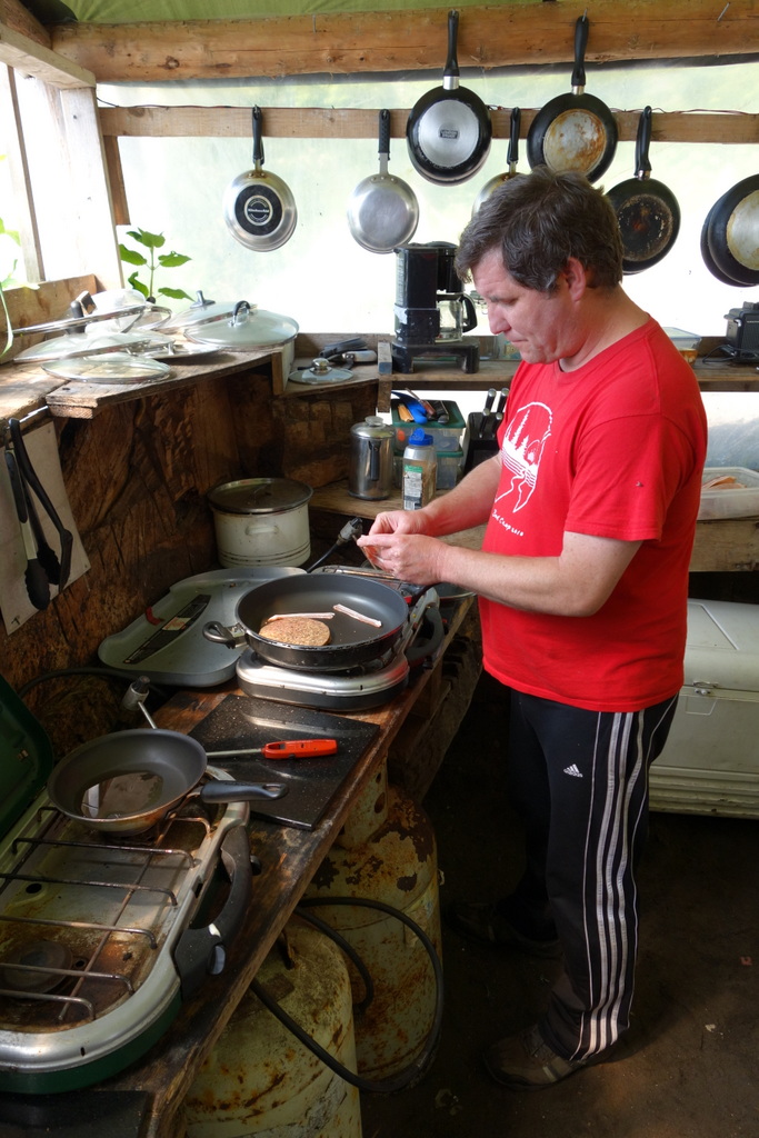
The trail continues along the beach for a long ways, offering up constantly fantastic views of the ocean. One of the best things about the WCT is that the scenery changes so much. Just when you’ve tired of the shady green forest it emerges out onto the pebble-covered beach. It always seems to know when you’ve had enough of the scenery you’re walking through and then changes suddenly. I walk for a few hours and the trail turns back inland, reentering the forest. But before following it, I find a nice spot to rest on a boulder rounded by waves and warmed by the sun. I get out my stove. I skipped breakfast this morning, partly in anticipation of a delicious burger and partly as an idea I got from a really good book about getting packed up then eating breakfast later once you find a nice spot to rest. Actually, I did that yesterday as well. When the rain really started to come down I found myself near an outhouse – they’re immaculate on this trail – and cooked up breakfast there. Shelter from the rain, warm oatmeal, and a place to do one’s business all in the same spot. You can’t beat that.
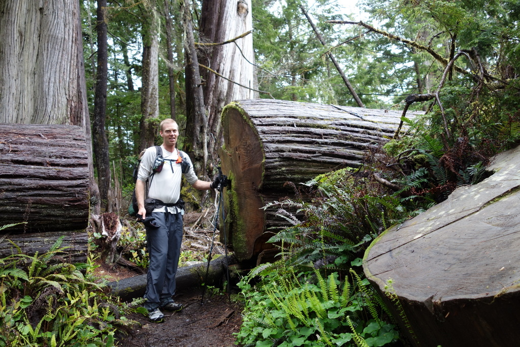
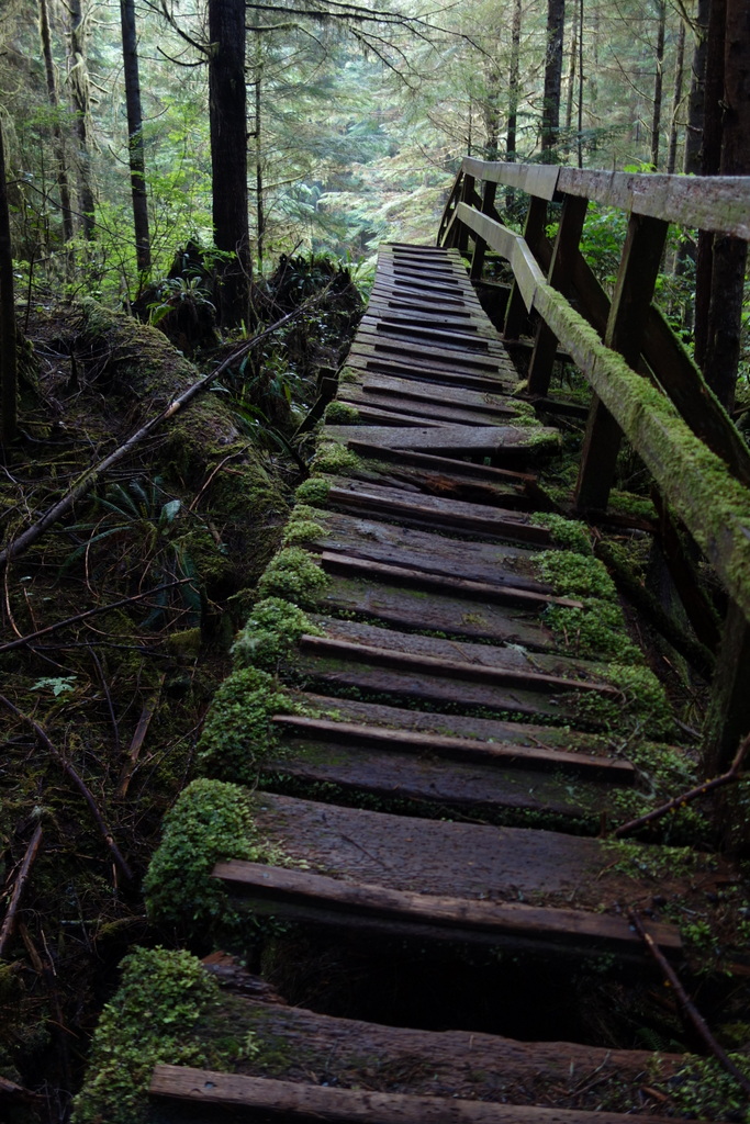
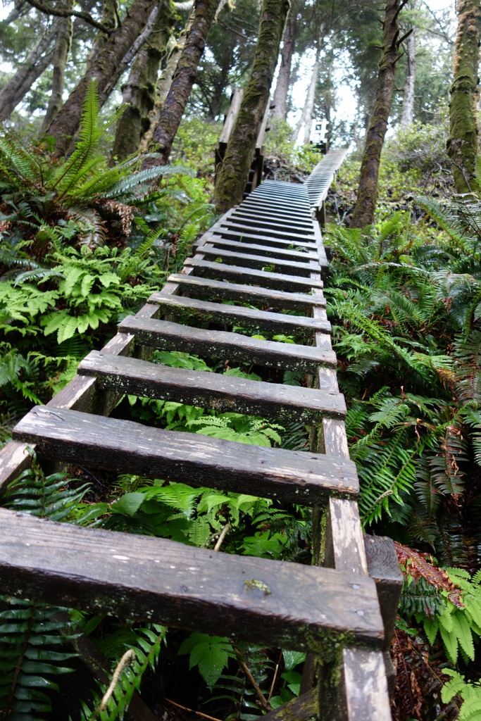
After eating my 2pm breakfast I head into the forest where the trail gets seriously rugged. Narrow slippery logs act as bridges, gnarly roots offer the only passage through bogs so deep and dark I’m afraid to step in them, and steep ladders are the sole way of getting up and down sheer ravines. Not just one ladder but tiers of them. One after the other after the other. Like climbing a multi-story building. I’m thankful for these modern additions to the trail, though. Back when the trail was used primarily to save shipwreck survivors, the trail itself was a serious survival test. The rivers had to be forded and looking at the wreathing, twisting rain forest, I can hardly imagine how anyone could get through it without a well blazed path. I climb up more ladders and pull myself across more cable cars, finally emerging at Camper Bay. I watch as the creek and incoming tide do battle, forming strange chaotic waves where the two meet.
Day 4
Camper Bay to the end at Gordon River
Distance walked: 13 km
Hikers encountered (going opposite way as me): 4
Hikers encountered (going same way as me): 2
Lunch: gooy date-nut bars and my last avocado drizzled in olive oil, dried cranberries, and sunflower seeds
My right foot hurts this morning. It feels like I’ve irritated a tendon on the inside of the foot. If I turn my foot inward, I feel a sharp pain. It’s tolerable but concerning. I have only 13 km to go but the bus back to Victoria runs only this evening and then again in two days. I have plenty of food, I’ve walked a lot faster than expected, but the idea of spending two days walking what would normally take me only a few hours seems unappealing. I decide to continue on at a nice slow pace. If I can stretch it out I’ll still get to the end on time to catch the bus and my foot should be ok. I hope.
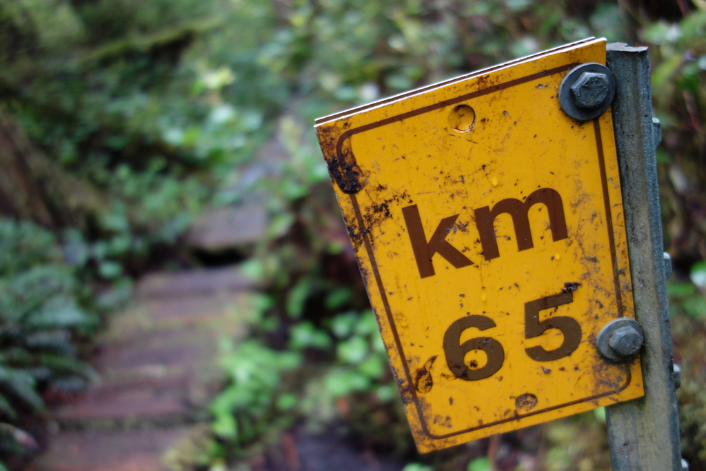
The steep ladders resume. Up up up. I go slowly, stopping on platforms between each one to rest my foot. It’s the ladders that really bug it. The trail has so much more up and down today. But I was ready for this. The cook at Chez Monique’s warmed me that the last 5 km are the hardest. I think I’ve figured out why. At km-65 I get a great idea. Wouldn’t it be fun to have a photo of each milepost, counting down the final 10 km of the trail? I start composing artistic shots. This helps me slow down and I really enjoy my surroundings. I walk on, making sure to watch out for the km-66 sign. It feels like I walk for a long ways. Then “67” appears. Did I miss it? I was pretty careful, I made sure to keep a close eye out for it. I conclude that somehow I passed it by. Then 69 is missing. Then 71! So much for my photo concept. At km-70 there is a signpost indicating only 5 km to Gordon River, the end.
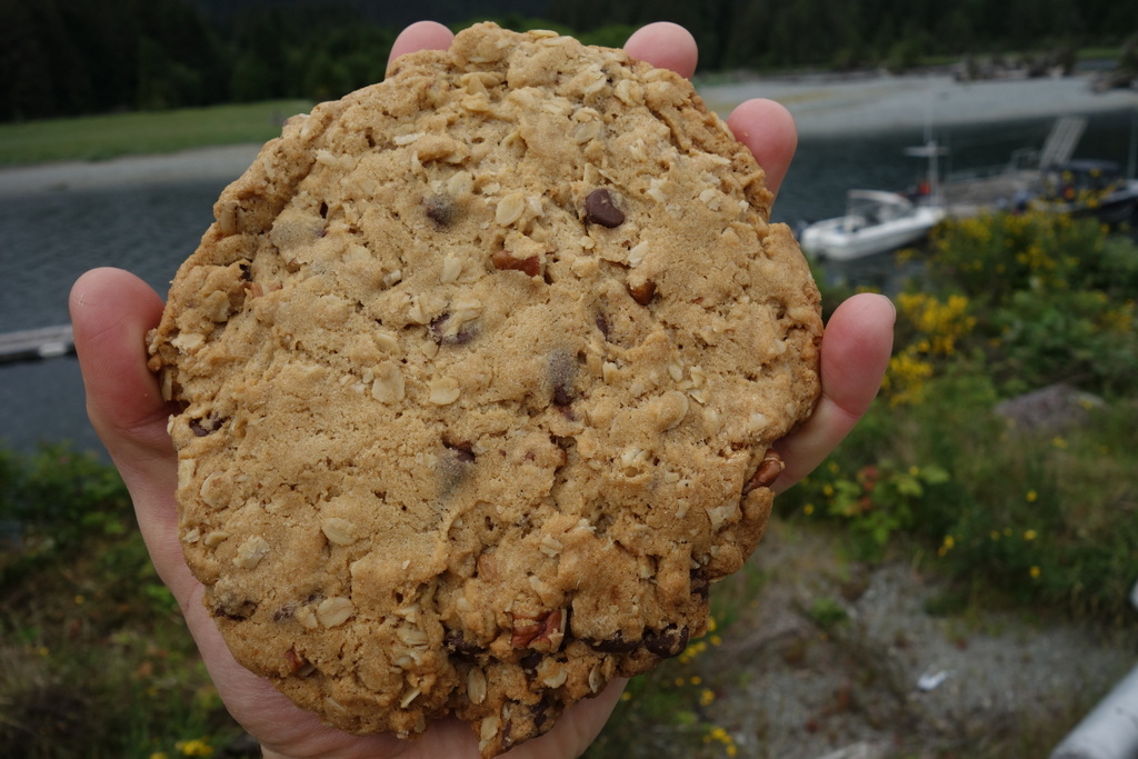
I’m really surprised that I’ve seen no one today. I walk on for a few hours more and finally encounter a Dutch couple and two women from Vancouver hiking the trail for the second time. They tell me I’m crazy for hiking it from the north. Get the tough stuff over with at the start, they say. The Dutch couple ask “have you seen anything dangerous?” I tell them about the two bears I saw on the first day and they seem really unnerved. I describe how little the bears where and how they were just doing their own thing, but these woods seem to really spook the couple. They think the whistle of a thrush is actually lost hikers calling out for help. I wish them good luck and continue onward. Finally, I reach the end and break out of the forest to see Gordon River and a little community before me. I’ve walked slowly, but this has taken absurdly long. I’m sure the last 5 km of the trail are the hardest because there are actually 10 of them! A local picks me up in his boat and takes me across the river to the ranger station. I wander down to a campground and buy a huge chocolate chip cookie.
I really enjoyed the West Coast Trail. My foot got better fairly quickly and my shoes dried out after Mike and Tanya took me in at their house in Victoria (the hostel I was staying at was completely full!). If I ever return to the WCT I’ll do it in the opposite direction – not because I think it will be so much easier but just for variety – and I’ll try to slow down and spread it over a full week. There’s so much to see.
* actually, the tent is made of cuben fiber, but “nylon” sounds more artistic to my ears

Hi there, this weekend is nice in support of me, for the reason that
this occasion i am reading this impressive informative
article here at my residence.