Part 1: Edziza Spectrum Range Traverse (this post)
Part 2: Crossing the Edziza Plateau
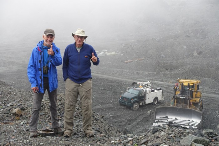
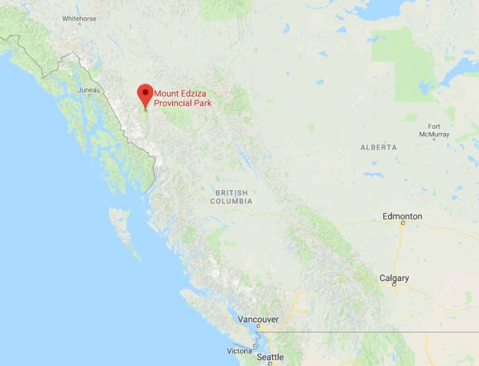
In northern BC there’s a rarely visited park that I hadn’t even heard of until a few months ago. My good friend, Jim, was putting together a trip to visit the asbestos mine (yikes!) where he used to work years ago and Mount Edziza Provincial Park just happens to be a stone’s throw away. To make the trip even more special, Jim invited Calder who also worked in the mine. They hadn’t seen each other since 1971!
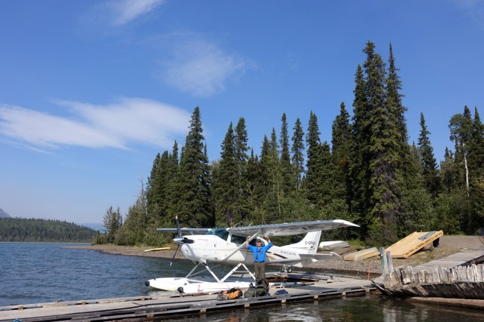
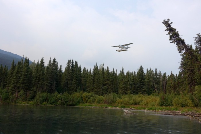
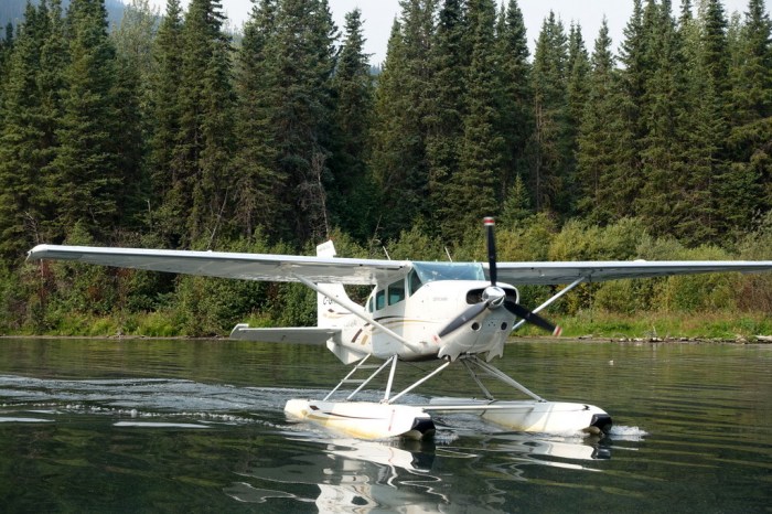
The only practical way to get into Edziza is to take a float plane. The drive to Tatogga Lake (where you catch the plane) was quicker than expected so we wandered down to the airline office (it’s a yurt, of course – this is northern BC) just to see what conditions were like in the park. We were scheduled to fly out the next morning but the pilot, Bryan, said “hey, I’m not doing anything, want to go now?” Wow! Can you imagine that from any big airline? The last time I asked to move my flight a day earlier I’d just been in the Nepal Earthquake, still covered in debris, and the airline wanted an extra $500! Thanks Air Canada.
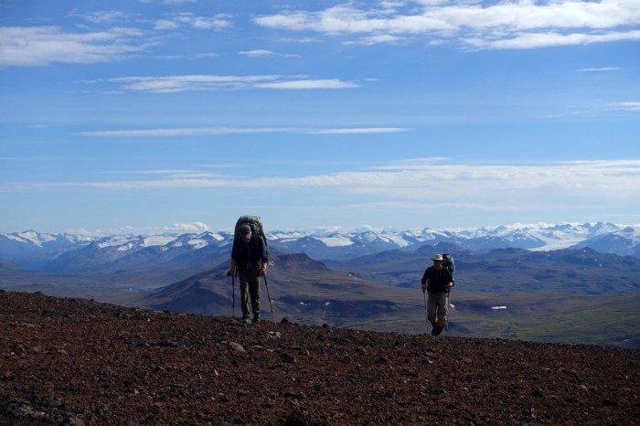
Day 1 – Little Ball Lake
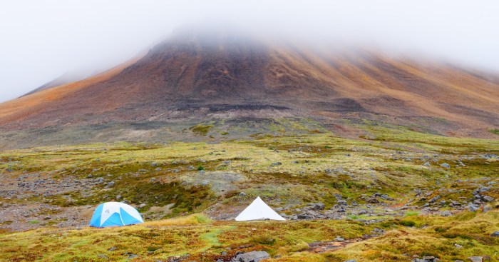
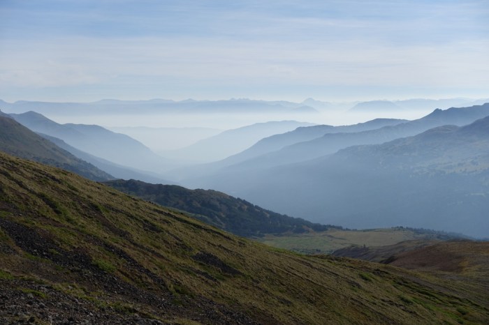
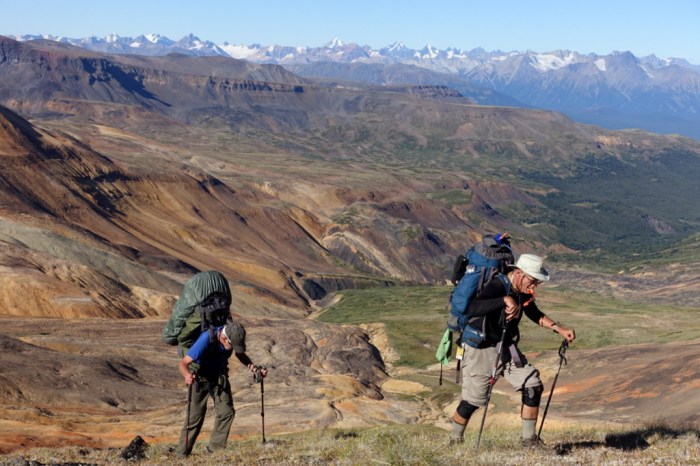
Since we flew in a day early but late in the afternoon, we just strapped on our heavy backpacks loaded with 10 days of food and began wandering without any intentions of going very far.
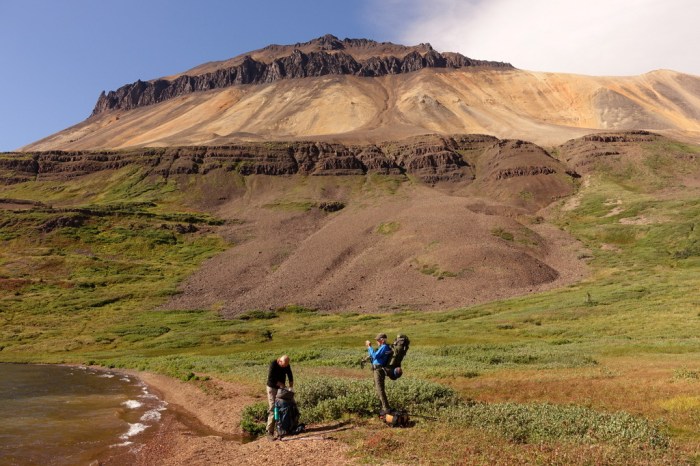
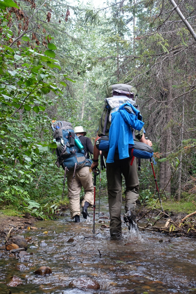
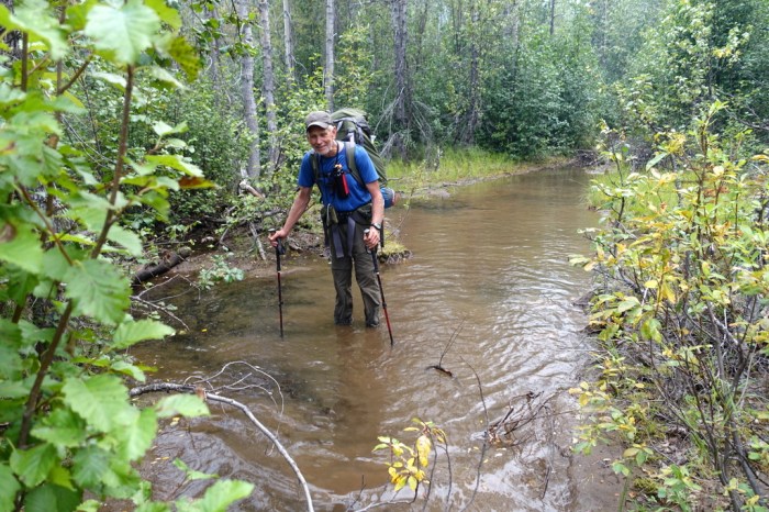
After a mile or so we got to our first stream crossing. We’d read that these are frequently difficult. The creeks are glacial fed, so you can’t see the bottom, and they swell to scary proportions when it’s hot and the glaciers are melting quickly.
Our first challenge complete, with no one taking a swim, we decided to set up camp right above the creek. Despite the amazing scenery, I fell asleep in no time.
Day 2 – Ball Creek to just south of Kuno Peak
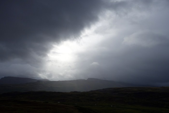
I awoke to rain falling on my tent. It was cold, windy, and wet. What a change from yesterday. It kept raining all day and we realized how lucky we were to arrive a day early. In these conditions the float plane probably wouldn’t even take off.
We climbed up a gentle pass not too far from Little Ball Lake and thought we were doing pretty well until we saw what was down the other side. Imagine a super narrow gully, guarded by the mud-covered ice of a dying glacier, with steep muck on one side and, on the other, slabs of slate that just want to break your ankle. And this is the easy way!
We took our time and worked through the rough terrain. The rain actually took a few breaks and we enjoyed the moody atmosphere created by the fog.
We all crashed early. I was fast asleep by 6pm and barely moved all night. When Jim woke up he saw that it was a beautiful day with vibrant sunshine. He quickly got dressed and ready to go, surprised that he’d slept in until 8. Then he had a moment of panic – “why is the sun rising in the west?!” It was 8pm 🙂
Day 3 – Yagi Ridge
If we thought yesterday was challenging, we’d soon realize it was just a walk in the park. Our objective for the day: imposing Yagi Ridge.
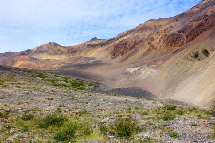
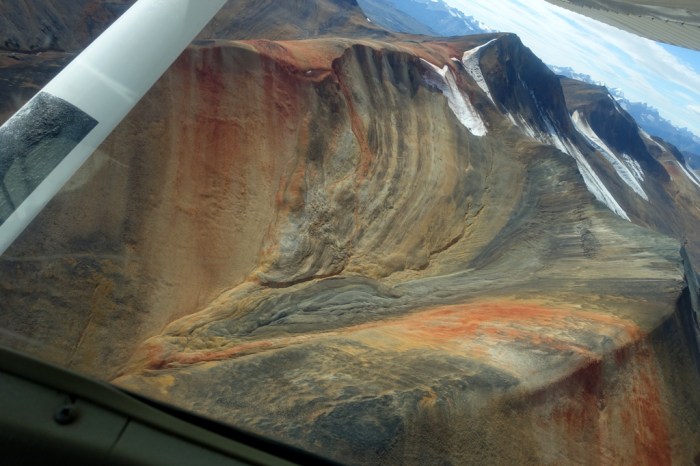
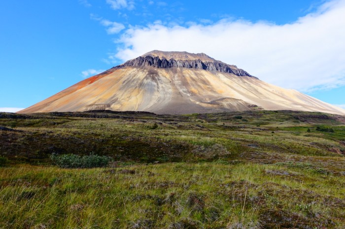
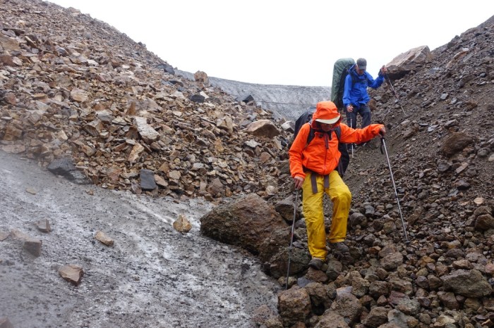
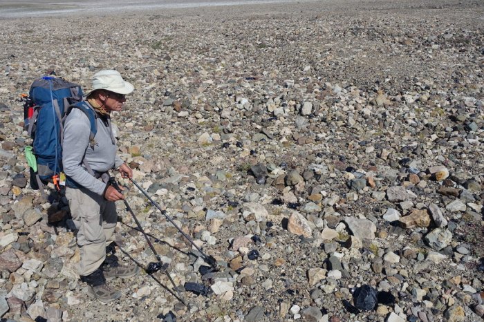
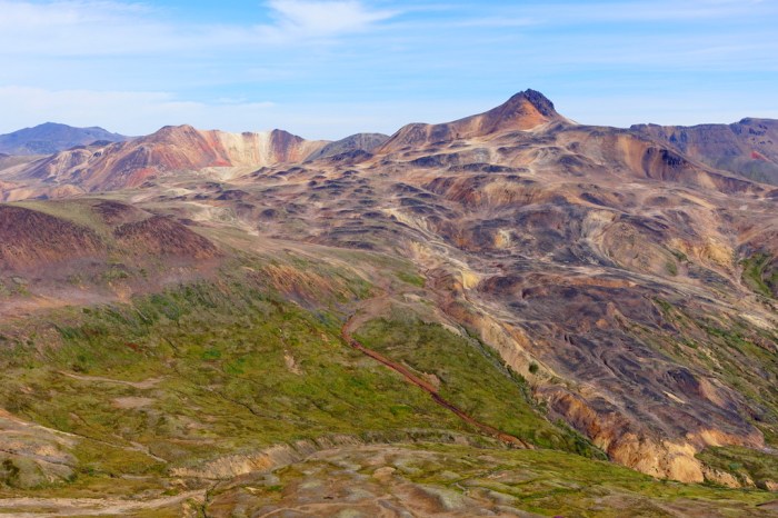
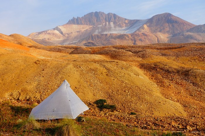
Yesterday’s muck was replaced with large blocks of unstable volcanic rock. Edziza is actually Canada’s highest volcano and its numerous eruptions (as recently as 1000 years ago!) have haphazardly spewed rock all over this landscape.
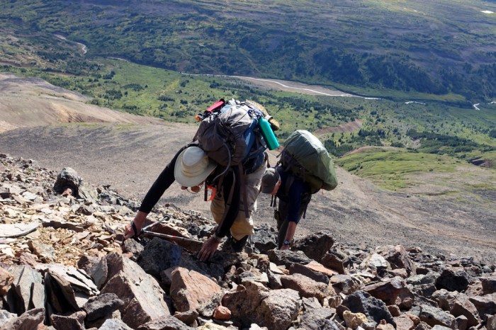
Not only is the rock loose but the ridge is really tall and it gets seriously steep as you near the top. I was so glad to have mountaineering boots to kick steps when I could. Jim and Calder both agreed this was the hardest hike they’ve ever done. And they did it with really heavy packs. You have to be damn tough to work in an asbestos mine.
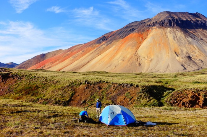
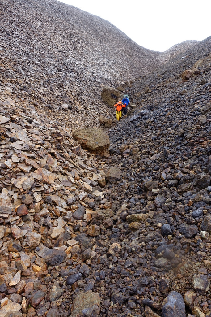
After a much-needed rest we descended down the other side. Thank goodness it was much less steep and covered in deep scree so you can actually run down much of it. We made camp above Nagha Creek, which we were even more worried about than Yagi Ridge. Much more.
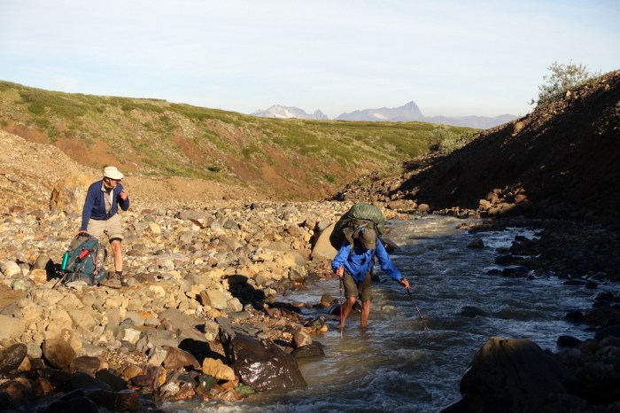
Day 4 – Nagha Creek to Raspberry Pass
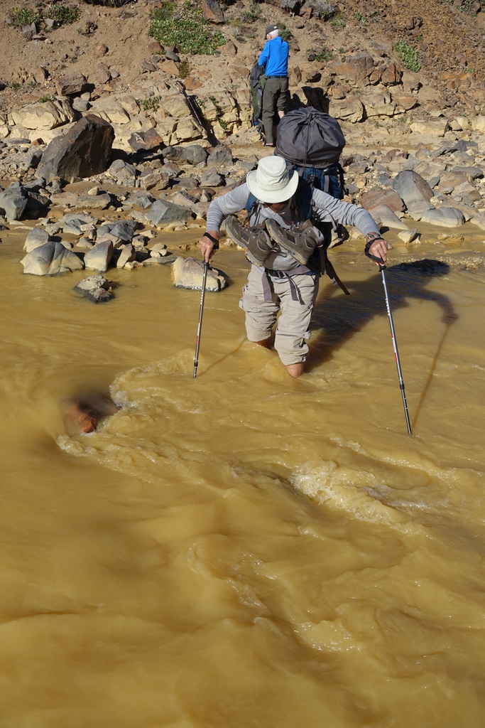
Nagha Creek is known for being uncrossable. It’s steep, deep, powerful, and erupts full-force straight out of the glacier, leaving few options. Many parties walk well out of their way to the toe of the glacier where they cross over a sketchy ice bridge.
We planned to cross early in the morning, long before the hot sun starts to attack the glacier and swell the creek. We couldn’t believe our luck – it was actually a pretty easy crossing. I even found a place to jump across and didn’t even get my feet wet!
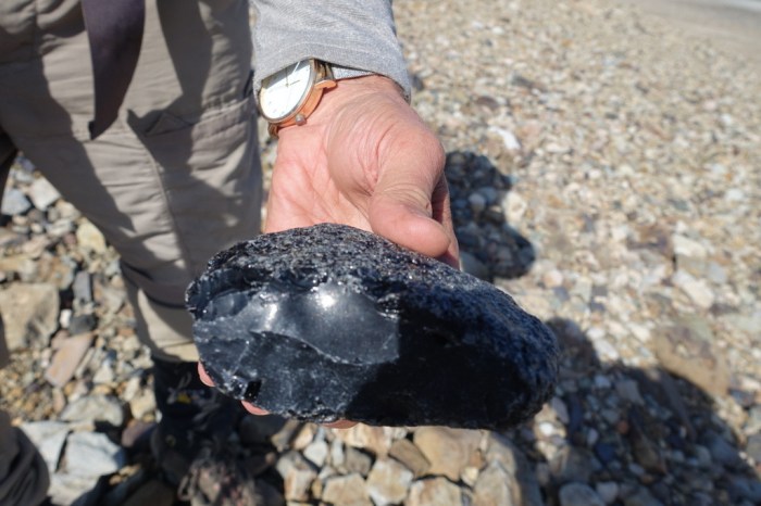
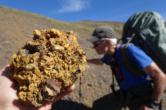
Once we got across the creek and up onto Kitsu Plateau, we were in for a treat – long, flat, easy walking on rocks that seemed to have arranged themselves as neatly as cobble stones. Suddenly, Calder let out a loud cry. “I found obsidian!” We were so excited to find this unique volcanic glass, the sharpest naturally occurring substance on earth.
Obsidian was actually a game-changer for the native tribes in this area as it allowed them to hunt game with thick hides, like mountain sheep and caribou, whose skin they could never pierce previously. The rich deposits of high-quality obsidian also turned Edziza into a sort of world trade center. Obsidian from Edziza has been discovered throughout BC and Alaska and possibly as far away as California!
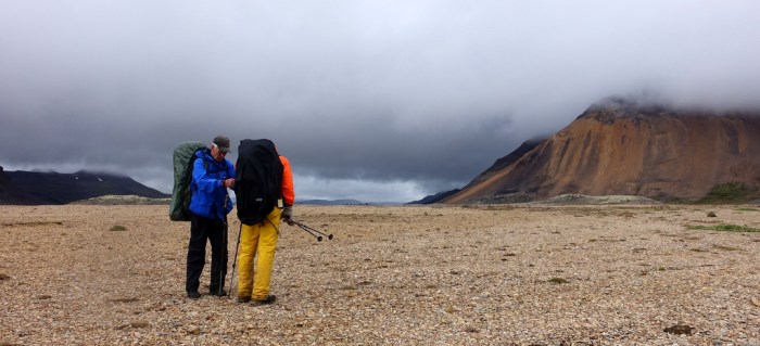
The walk across Kitsu Plateau was pleasant and we soon descended to Raspberry Pass.
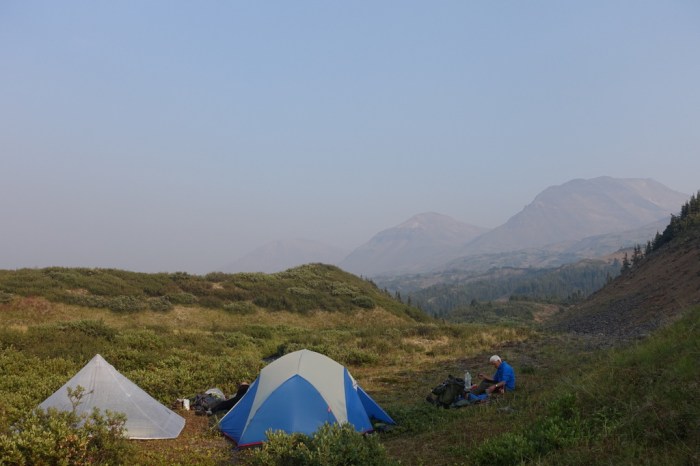
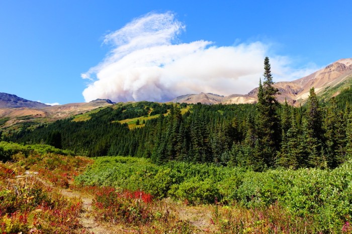
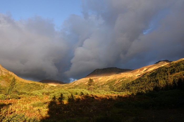
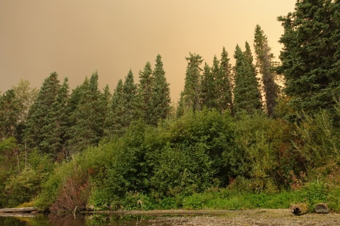
The trees and bushes and grass created a beautiful green tapestry we hadn’t seen for the last few days up on the rocky ridges and plateaus. But there was something else much more ominous – forest fire smoke. A large fire was burning in Telegraph Creek, just north of Edziza and in the direction we were heading. Was it now heading toward us?
Day 5 – Raspberry Pass to Walkout Creek
We awoke to better conditions. The smoke seemed to settle down into the valleys far below us over night but we found ash on our tents in the morning. Not a great omen. At this point, though, there was no way we were going to head back across all the miles we’d covered and, especially, not back over Yagi Ridge. We were committed.
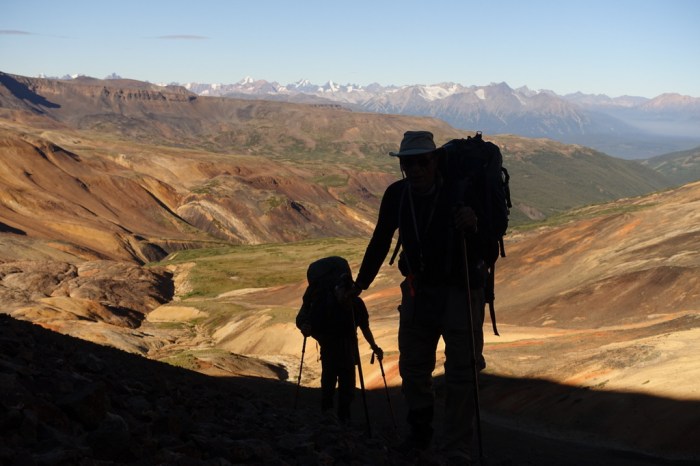
Calder led us up the slopes above Raspberry Pass, searching for passageways hidden among the leg-grabbing bushes and trees. What a maze. Occasionally, we had to push right through the trees. Every day is a new challenge.
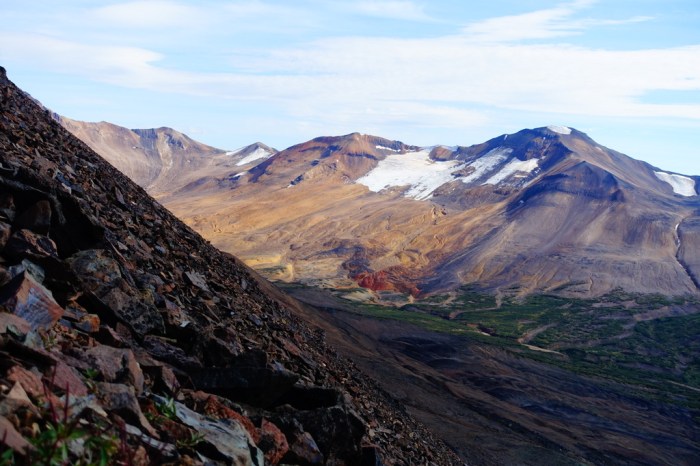
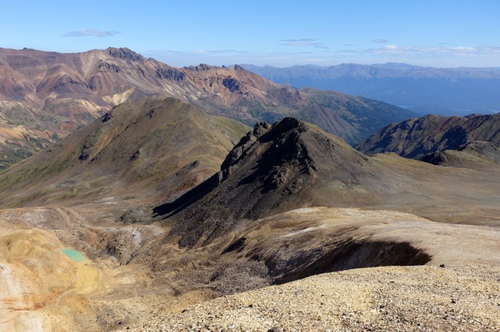
We reached the plateau above all the bushwacking and the views just blew us away. What an amazing place this is!
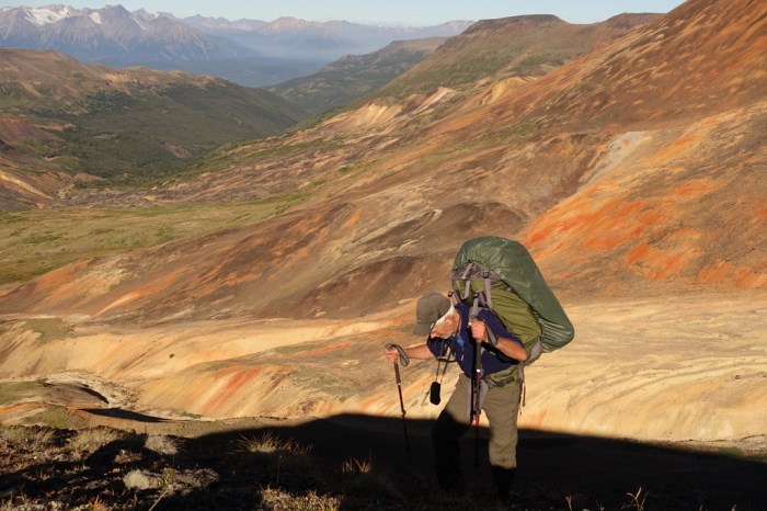
I also enjoyed checking out all the cool rocks. I should have been a geologist.
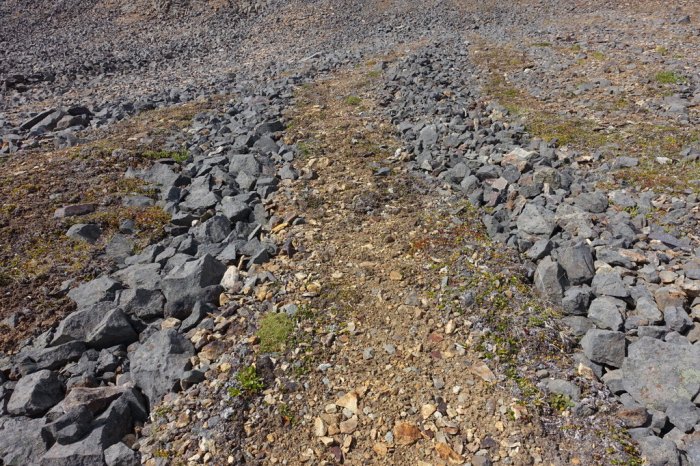
Somehow the rocks on the plateau had arranged themselves neatly into channels. Between them was soft dirt, making for wonderful walking. One day you get slick muck, another big loose volcanic blocks, and then nature decides to give you a manicured expressway. Maybe Edziza was trying to teach us something.
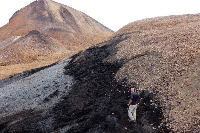
In many parts of the world glaciers are receding at an incredible rate. You really feel that in Edziza. At a rest break I walked out onto the dying remnants of a glacier. It made me think of cancer. Apart from Mount Edziza itself, all the glaciers in this area are already beyond the point of no return – they no longer have enough mass to flow downhill and instead just dwindle into a distant memory year by year.
Once up high we saw that the forest fire smoke was still pretty serious. A quick call to Alpine Lakes Air on the satphone confirmed that the north part of the park was closed. Our planned 10-day traverse of nearly the entire park would be cut short and we’d be forced to walk out to Mowdade Lake, which we’d been told was a horrible boggy mess.
Yet, with views like this, we were happy just to be here and soak it all in. Sometimes life throws you a curveball. Just make the most of it.

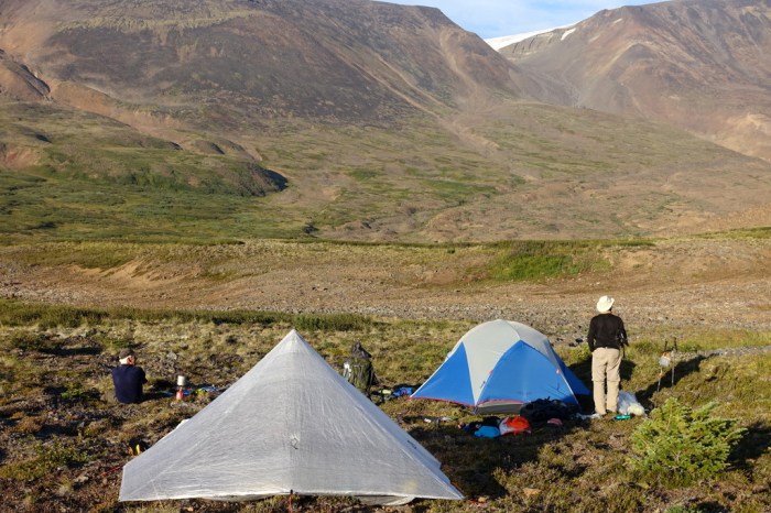
Day 6 – Walkout Creek to Chakima Creek horse camp
I had a surprise for Jim this morning. We headed out in exactly the opposite direction he expected. Calder, who was never too concerned about exactly where we were headed, noted the steep ridge in front of us and commented “we’re switchbacking up that?”. “Yep,” I replied. “Wait, what?? You’ve got to be kidding me!” Jim let out in an exasperated tone. “Yeah, this way is better”. And by “better” I meant the views, despite it being a pretty strenuous start to the day.
Once we reached the ridge crest Jim instantly forgave me. What amazing views! The intense red, yellow, and orange colours – like fire – of the ridges around us flowed down to the distant giants of the Coast Range, covered in their massive glaciers.
We then had a few options. We could either traverse the ridge and drop down to Chakima Pass or descend down the backside of the ridge to meet Chakima Creek below the pass. We went with the easier option, which saved us loads of time and effort. I must say, though, if anyone does traverse that ridge, it looks spectacular.
The descent down the ridge was lovely. First, we found a fantastic goat trail. It looked as though they’d moved every rock into just the right position with their sturdy hooves. This made me so happy. I’m really bad at finding goat trails, even if I spot them from a distance.
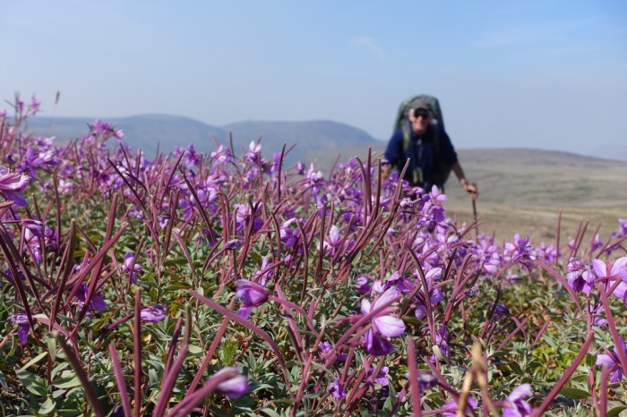
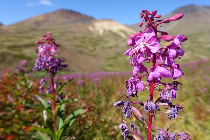
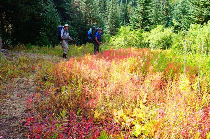
As we got lower and lower, the plant life started mimicking the intensely coloured rock, putting on a brilliant show of blooming wildflowers and fall colours.
Our impromptu descent worked out perfectly. We made it down to Chakima Creek without any bushwacking at all. We were overjoyed when we suddenly came upon a horse trail. What a pleasure to walk on groomed single-track after having to watch our footing so carefully for the past six days.
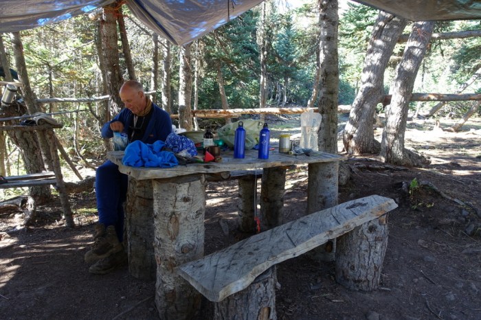
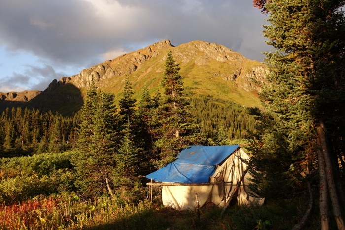
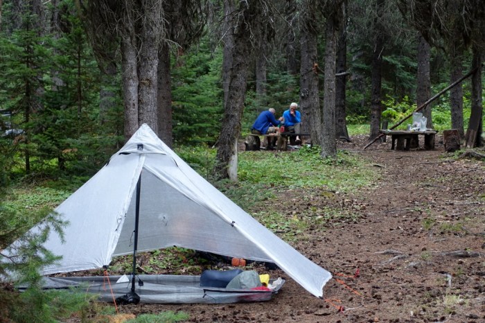
As we continued down the trail we stumbled upon something rather unexpected – a horse camp. This isn’t just any horse camp. After wild camping every night, we suddenly found ourselves sitting at a log picnic table with shelves to store our gear, tarps to keep us dry should it rain, and a mirror to make sure we look good. There’s even an anvil and a propane torch to fashion horse shoes. Talk about luxury.
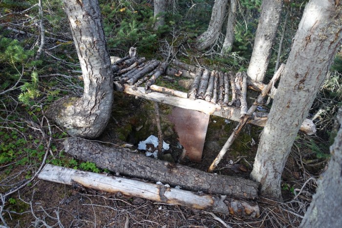
Except for the toilet, that is.
Day 7 – Mowdade Lake
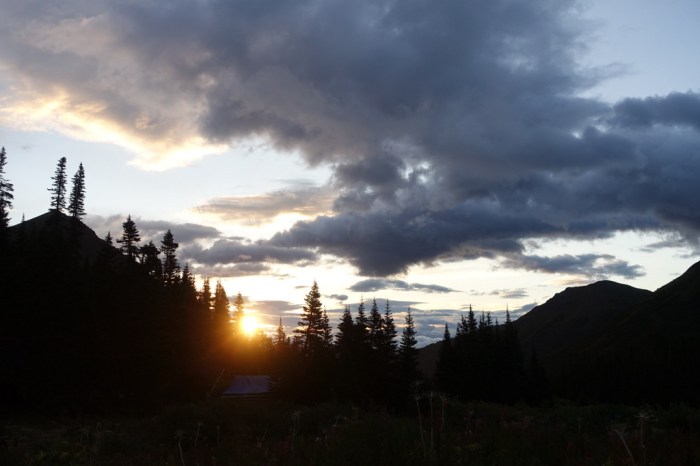
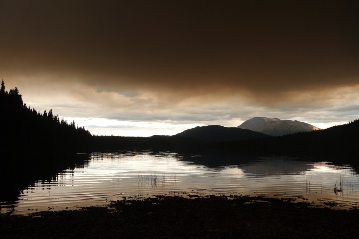
The morning brought cooler weather and it looked like it might rain. But sunrise was beautiful and the morning light turned the valley a crisp golden that you only get as autumn approaches.
Even on our final day we were a little apprehensive about how difficult the walk down to Mowdade Lake would be. We’d heard horror stories about having to wade through chest-deep beaver ponds and people getting swallowed up whole in gooey, stinky mud bogs.
To be honest, it wasn’t that bad. I actually really enjoyed the walk. There’s so much variety in this park. Finishing with a walk straight down a creek through the forest seemed so fitting. Edziza kept the experience fresh and exciting to the very end.
The final morning
The next morning the float plane swooped down and picked us up. It was a moment of excitement and relief (that the fires hadn’t grounded the plane, trapping us forever) but also a touch of sadness as there’s so much more we wanted to see. We just might have to come back.
Oh, here’s a great film that inspired us to go on this adventure. It does a better job of capturing the vibrant colours of this place than any of my photos. The full-length version is well worth watching. Colours of Edziza
Here’s another great documentary: Edziza: Life from Ash and Ice. This one is free.
Route Planning and Advice
For those planning their own trip to Edziza (specifically, the Spectrum Range), here are a few notes:
- Much of the terrain is rugged – the kind you’d encounter on alpine climbing approaches.
- Know how to plan & navigate cross-country routes. It’s not really that hard but if looking at a topo doesn’t generate a 3D image in your mind, you’ll likely struggle.
- Micro-navigation / route-finding can be challenging. The mix of volcanic formations and glacial moraine creates some complexity.
- The north part of the park, which we didn’t get to because of the fires, is more gentle and a completely different experience.
- For the most part, we had great weather but Edziza is known for being cold and wet with high winds. Come prepared.
- Be prepared for some difficult creek crossings. Plan to cross them early in the morning if they’re running high. Or come late in the season (late Aug) like we did.
- The topo maps were produced in 1974 and haven’t been updated since. The glaciers have receded significantly since then, so expect reality to look a bit different than your map indicates.
- As noted, most of the glaciers no longer flow, so the risk of a crevasse fall is low, especially if you come late in the season. Most of the glaciers we observed were 90-100% dry. This opens up some interesting glacier routes without the need for anything more than crampons.
- Don’t rush it – you want to soak up as much of this beautiful scenery as you can!
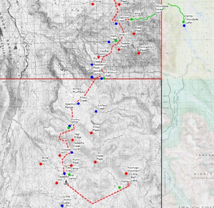
Here’s our rough route:
- Fly into Little Ball Lake
- Walk up small pass WSW of Little Ball Lake
- Cross flats between Kuno Peak and Tadekho Hill then Outcast Hill
- Ford north fork of Tadekho Creek
- Ascend Yagi Ridge via obvious weakness (downstream, not right in front of you, although you could try this too. The least steep ascent is actually right under Yeda Peak but this will have you top out onto ice). Use benches to get about half way up then it’s just a steep loose grunt.
- Descend Yagi Ridge via scree runs
- Ford Nagha Creek. We found a fairly flat stretch and did it first thing in the morning. Alternatively, head up to the toe of the glacier.
- Head for the low saddle at the far end of the plateau
- Follow open areas and game trails down to Borgeau Creek. You’ll meet the creek a little to the E of Raspberry Pass proper.
- Ascend the other side of Raspberry Pass, connecting open areas and following the animals again.
- Cross the plateau then work your way down the ridge below Cache Hill. I was surprised how quickly a use trail is developing here. But, first, stop at the edge of the plateau for amazing views.
- Work your way through the interesting terrain below Tadeda Peak. Either drop down to Walkout Creek or stay high, descending via the eroding moraine (which we did).
- We then climbed up the ridge NE overlooking Walkout Creek (this would make a spectacular traverse) then picked up a fantastic goat trail to descend much of the way down the first valley to Chakima Creek. This has you meet the creek considerably below Chakima Pass, so if you want to continue to Buckley Lake, you’ll want to head to the pass from Walkout Creek, picking up a horse trail on the way (or do the ridge walk for a more interesting route).
- Once on the horse trail it’s smooth sailing (ok, there’s some fun mud and walking through water to negotiate) all the way to Mowdade. Camp at the horse camp and catch a flight out the following day. You could do the entire horse trail in a single day but it’s more pleasant to break it into two, spending one night at the mid-way horse camp.
I didn’t record our actual walked route, with the exception of our final day (my one and only regret from this trip), so I don’t have a gpx to share. But why would you want to follow someone else’s route anyway? Edziza was made for cross-country adventures and there are countless different ways you could navigate your way through. Embrace the unknown.
Part 2: Crossing the Edziza Plateau

It looks amazing. But also sound a bit scary with the old mine which might have left something behind. And I guess it takes some time planning to do a trip like this.
Thanks Freja! It definitely was amazing and well worth the planning. Yep, the mine had me on edge but luckily it was raining when we visited so no dangerous dust to accidentally breathe in.
I guess sometimes you do appreciate the rain.
Extraordinary location! Great photos, thanks for sharing these so I never have to go outside again…
It looks like an amazing trip. It’s too bad the smoke and fire risk made you cut your trip short.
The blog and pictures are wonderful. Great job documenting your journey. The beaver ponds were definitely, I thing a low point for us, but the colors of the park, especially the cones were the highlight. And, getting to the top of Eve Cone. We saw that horse camp, but it wasn’t in good shape when we were there. Someone must have done some work on it. What a journey. I’m glad you made it, had a great time, and shared it with the rest of us. Not exactly a stroll in the park.
Thanks Dan. I think we were quite fortunate with the dry conditions we had. The beaver ponds weren’t really that deep at all. I guess that’s the positive side of the hot & dry conditions that make the fires so bad. Eve Cone looks amazing in your video and I hope to go back to Edziza one day to see that part of the park too.
Hello, it seems wonderful ! I’ve got 2 questions :
– How much did it cost you to get there (Floatplane)
– When did you reserve the plane ? 3 months before or later ?
Hi Jessica,
We paid $1000 CAD total to fly into Little Ball Lake and out of Mowdade Lake for 3 passengers. The cost depends on which lakes you choose. We booked 3 months in advance. I think the further in advance, the better, especially if you’re planning on going during hunting season. Alpine Lakes Air gets busy then. The day before our scheduled flight we were planning on camping near Tatogga Lake (Alpine’s base). We got there earlier than expected, so we thought we’d just stop by and chat about conditions. To our surprise, the pilot said he didn’t have anything else to do and that he could fly us in right away. That was really fortunate, as the next day was too rainy and no flights went.
https://www.alpinelakesair.com
We’re actually planning to do another trip to Edziza next summer. If you’re interested to join us or just bounce ideas off each other, let me know.
Good luck with a great adventure. It’s a spectacular place!
Hello Justin, thanks for sharing your trip, the photos are just incredible!!!. I’m planning to do a trip in the Edziza park this summer and I’m looking for some GPX files of the area. Would you be willing to send me the track you have recorded on Chakima trail down to Mowdade lake.
Thanks
Gabriel
Hello,
My wife and I just completed the traverse from Little Ball to Buckley over 6 days. Your notes on the Spectrum Range came in great help and both trips you did inspired us to do the full traverse in one go as the flight is much more expensive now that there is only one company offering trips out of Dease Lake. Thank you for posting your trip route details! Without your intel it would have been a more daunting challenge. What a magical place. Yagi ridge was definitely the crux. I think we took the wrong line but it worked out. Thanks!
That’s great, Damien! I’m glad that your trip went so well and I’m happy that our trip inspired your own adventure. Edziza is a special place that not many people know about. We’re some of the few lucky ones that have gotten to explore that magical landscape. If you happen to post your own trip report or photos from your trip, I’d love to see them.
Hi Justin,
If you’re interested, I’ve posted the gps files of our route on Strava. It’s cool to see the satellite, 3D image of the route.
https://www.strava.com/athletes/waugh_who
Photos and summary of each day on Instagram:
https://www.instagram.com/waugh_who/
Best,
Damien
Hi Justin,
I’ve posted the gps files of our route on Strava:
https://www.strava.com/athletes/waugh_who
Photos and summary of each day on Instagram:
Couldn’t post this for some reason. Feel free to check it out: https://www.instagram.com/waugh_who/
Best,
Damien On Fri, Jul 29, 2022 at 7:51 AM Eating Snow Around the World < comment-reply@wordpress.com> wrote:
Sounds like a great trip Justin. Did you just finish the Akshayuk Pass? I’m pretty sure I met Jim on the pass this summer at the Glacier Lake hut. His description of the park sold me on the trip.