Kananaskis Lakes to Highway 93 – 126km
June 11 – Camping in the Snow
A few days after the big snowstorm, I returned to Kananaskis Lakes for what is perhaps the most popular and busiest part of the entire Great Divide Trail. Sil and two good friends joined me for the first half of the day.

Not long after I said goodbye to Beacon and Maggie, I hit snow. And, boy, did I hit it. Wet, deep, sticky. With every step my snowshoes sunk in deeper.

After post-holing up to my hips, I decided I’d had enough. I’d made it less than 2km in 2 hours. With more than 5km left, I knew there was no way I would make it over the pass before dark. Luckily, I found a bit of bare ground protected by a stand of trees and dug out the rest.

June 12 – Show Me The Way
The next morning I got an early start (I prefer not to check the time when I wake up but after a few hours of walking my phone said it was 7:30am). The night had been cold enough that a good, supportive crust had formed and the snowshoeing went much quicker.

When everything is covered in snow, you have no idea where the trail is and navigation can sometimes be tricky but I had no problem at all. Someone else just happened to be going the same way and knew exactly where to walk. All I had to do was follow his (or her?) big footsteps.
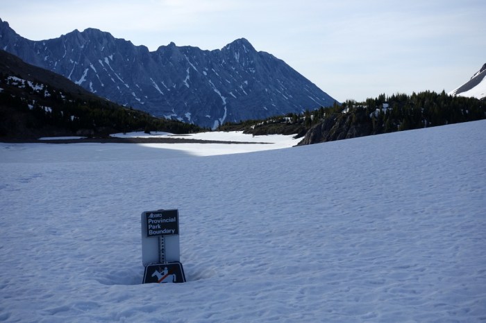
The snow disappeared on the BC side of the pass but it wasn’t long before I regained altitude and hit more of the white stuff. The top of Palliser Pass is surprisingly flat and I’ve discovered that the flatter the ground, the softer the snow.
Luckily, Palliser Pass is a little lower and shorter than North Kananaskis, so it didn’t take me too long to get through the hardest of it. Just when I thought I was in the clear, though, I broke through a big hole. I was walking directly on top of the trail, which was actually a trench with water running through it. My feet weren’t exactly dry before but the slush made sure they were now thoroughly soaked.

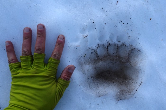
On the plus side, I had another guide showing me the way. On the snow I was following cougar tracks (I stopped yelling “hey bear!” and switched to “kitty kitty kitty”). Once off the snow, it was a bear again, this one even bigger.

June 13 – Friends Return
Snowshoeing in spring is hard work so it felt so so good to reach solid ground. I loved the remote, wild feel of the Spray River valley and I felt confidence knowing, if I needed to, I could follow this river all the way to Banff.

It an be pretty lonely out here, hiking the GDT so early in the season when not another soul is around. I do love the solitude but it was certainly nice today when Sil and Beacon and Maggie walked in and met me with more food! We had a great visit until Maggie got impatient and decided it was time to get moving. So much energy.

June 14 – Canada’s Matterhorn
I camped at Marvel Lake and awoke to the most amazing views. Wow! I’m really getting into the heart of the mountains now.

Of course, it wasn’t long before I hit snow once again. I’d run into a trail runner at the campground the night before who had (amazingly) made it up to Wonder Pass and was on his way back out. He post-holed up to his knees and still kept going. With my snowshoes, it went much more easily (but, probably, no more quickly).

I’m getting pretty used to this snowshoeing thing. It’s actually pretty fun.

Mount Assiniboine is one of the most popular tourist destinations in all of the Canadian Rockies. So, it felt strange that there were no tracks heading down from Wonder Pass to this famous location. Strange also that the lodge was deserted, the ranger cabin empty, the hiker huts silent.

Even Lake Magog, at the foot of Mount Assiniboine looked cold, still frozen over.

I finally ran into two couples at the campground. With some 50 sites, only two were free of snow. No wonder no one is here! Luckily, I found a wonderful little “tree cave” with dry ground.

I spent the afternoon relaxing and soaking up the views. Now, this is a real mountain! Mount Assiniboine is often described as Canada’s Matterhorn and I can see why. It just towers above its neighbours and it looks very imposing.


June 15 – Another Tree Cave
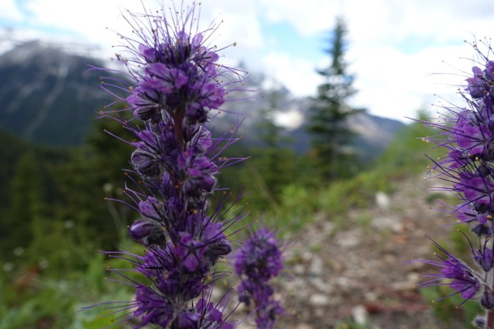
I enjoyed the hike out of Assiniboine. Wildflowers bloomed along the steep avalanche-scoured slopes and spring felt in full swing.
I suppose that peaceful warmth lulled me into a false sense of security and I walked a little far before deciding to look for a camping spot. Soon, I found myself back in the snow.

Howard Douglas campground was completely covered in snow. But wait, what’s that… another little “tree cave”!

June 16 – Empty Sunshine?
Sunshine is one of Canada’s popular ski resorts and the meadows are a very popular summer hiking destination. So, when I wandered into this famous spot and saw absolutely no one, it came as quite a surprise. Not enough snow to ski, too much to walk.

Having this all to myself is amazing. From Assiniboine all the way through Sunshine and to Healy Pass, I saw a total of four people and only one helicopter flew over. Normally, you’d expect to see hundreds of people and dozens of choppers.

June 17 – Pass All The Snow
Just two more passes before I reach the road and real food! Whistling Pass still had lots of snow but it was actually starting to become reasonably firm. So nice to walk on top rather than post-holding through.

When I reached Ball Pass I was amazed to see almost no snow on the trail itself. I had a good rest at the top, enjoying views of glaciers towering above me on Storm Mountain.

After a long walk on a forgotten trail, I suddenly ran into two familiar characters. Beacon & Maggie! My friends greeted me with cuddles and licks. We played fetch for another hour on the way down to the road.

It’s time for another break. I’ve discovered that the straps on my snowshoes really irritate my Achilles tendons, so I need some time to let them recover. Then, it’s on to the snowiest section of all – the Rockwall Trail!
Next Post: Rockwall Trail to Field BC

Outstanding pics, and great narrative, Justin. I’m feeling like a real slacker here in my comfy office. Jim
Thanks Jim! I have no doubt you’ll be up to some pretty exciting adventures too.
This is amazing to follow. I am more worried about you encountering animals than you are I think.
Thanks Jason. I do worry a bit about bears. And mountain lions. I just try to make lots of noise so I don’t surprise them.
Hello Justin, Thank you for the photos you sent me. They are very good. I guess those two dogs are Kureian dogs, dogs that are not afraid of bears in general. Quite spectacular the country side walking through the mountains. Enjoy and have a safe journey. When would you be back in calgary?
Michael T.
Thanks Michael. They are very brave dogs but I don’t know what they would do if they saw a bear. I don’t think they’ve ever seen one.
I think the hike will take me about another month to a month and a half. It depends where I decide to finish. Many people finish at Mount Robson because it is beautiful and the trailhead is right on the TransCanada highway, so that makes it easy to get back to Calgary. Some hikers go even further, all the way to Kakwa Provincial Park. That is about 200km further and it is very remote. There are sections with no trail at all. Even at Kakwa, it’s about another 70km to walk to a major road. I’m not yet sure which option I’ll choose but the walk to Kakwa sure sounds special.