I love long walks, especially when they take you right across a country from one coast or border to another. That’s the idea behind the TGO Challenge. Design your own route starting on the west coast and finishing at the North Sea, get advice from experienced Scottish hill walkers, and start walking. This isn’t my first country-crossing journey on foot but it is my first time hiking in Scotland and I was very grateful for the wise advice on such things as where to find beautiful camp spots and where I might want to avoid wind-farm construction. Continue reading “Walking across Scotland – the TGO Challenge”→
In just a few days I’m heading to Scotland to participate in an annual event where some 300 challengers attempt to cross the country on foot, each following a route they’ve designed themselves.
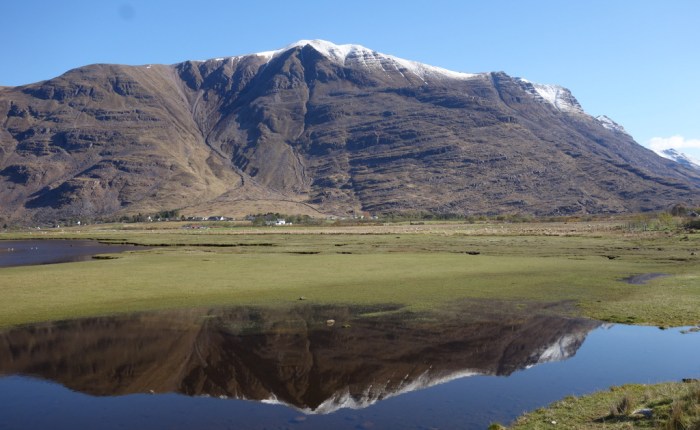
Each year The Great Outdoors Challenge is hosted by The Great Outdoors Magazine. It is a challenge, rather than a race. The goal for each participant is to walk from the west coast to the east coast across northern Scotland on foot in two weeks. No motorized transport is allowed, with the exception of taking a ferry across large lakes such as the famous Loch Ness. What makes this event especially interesting is that there’s no one defined route. There are many possible starting and ending points and you can choose any combination of trails, jeep tracks, forested glens, boggy moors, and remote highlands that you like.
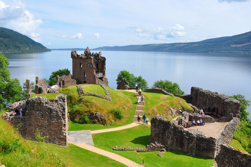
Urquhart Castle on Loch Ness. Photo credit: wikimedia.org
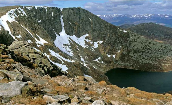
Scotland is notorious for cold, wet weather, especially in May. This year is shaping up to be quite a challenging one with heavy snow still falling and steep icy snowfields remaining on the high peaks. At the moment, the forecast for Lochnagar, one of the high points on my route, is “snow turning to rain” with “severe gales”. Continue reading “Scotland’s TGO Challenge”→
One of my favourite things about summer is big backpacking adventures. The Brazeau Loop, an 80-km long alpine traverse in Jasper National Park, is one of the best. But if it’s summer, you’d never know it on this trip. Here’s how it all happened… Continue reading “Backpacking Jasper’s Brazeau Loop”→
In 1811, explorer David Thompson went in search of a new route across the high Canadian Rockies. Hostile Peigan natives blocked Howse Pass (which now connects Mistaya Canyon with Golden) and the North West Company, for which Thompson worked, desperately needed an alternate route to ship furs across the mountain range. In January of that year, braving -30 temperatures, five meter deep snow, and perilous river crossings, Thompson reached Athabasca Pass. This route, connecting the Athabasca River (which flows out to the Arctic Ocean) and the Columbia River (which reaches the Pacific), became the main artery for shipping furs across Canada until the 1850s. Continue reading “Following the Fur Traders”→
National Geographic describes Tonquin Valley as one of the World’s top 15 hikes. We’re so lucky to have it in our own backyard. The local guidebook “Don’t Waste Your Time in the Canadian Rockies” calls it outstanding and says “not only is the valley girded by tumultuous topography, it’s broad, with enough meadowy viewpoints to allow frequent gazing – an ineffable joy on a clear day.” Some places just inspire poetic words. Continue reading “The Amazing Tonquin Valley”→
Vancouver Island’s West Coast Trail is a 75 km-long rugged coastal route through mud bogs, over slippery boulders, under huge fallen trees, up 70 ladders, across 130 bridges, and zipping over rivers inside 4 cable cars. I hiked the trail in May, when it’s especially wet and muddy.
Day 1 (May 29, 2013) Bamfield (Pachena Bay ranger station) to Tsocowis Creek Campground
Distance walked: 16 km
Wildlife seen: ravens, 2 black bears, hundreds of smelly seals
Hikers encountered (going opposite way as me): 7 (of these, 5 had just finished the trail)
Hikers encountered (going same way as me): 4
Lunch: fresh avocados with pork jerky, cashews, and chocolate
I wake up at 5:15am in my 6×10 foot hostel room. It’s a private room, but in a solitary-confinement sense. I eat half a dozen bananas then I’m out the door. It’s raining. Hard. I hide under the umbrella I plan to use on the trail. This 15 minute walk to the bus station is the only time I’ll use it for the entire trek, save 5 minutes under a big tree with pounding rain smashing through the upper leaves.
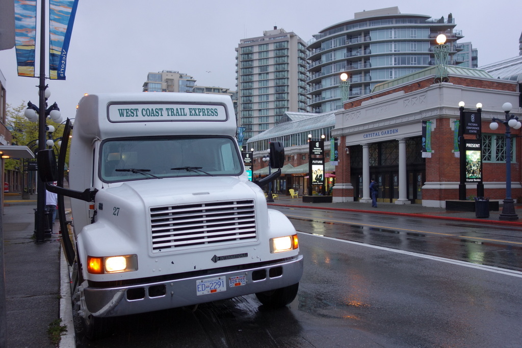
The 6am West Coast Trail “Express” bus departing from rainy Victoria – May 2013
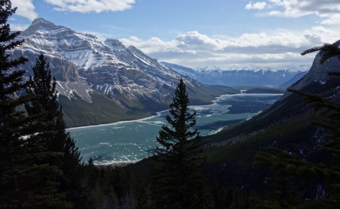
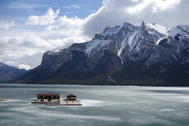
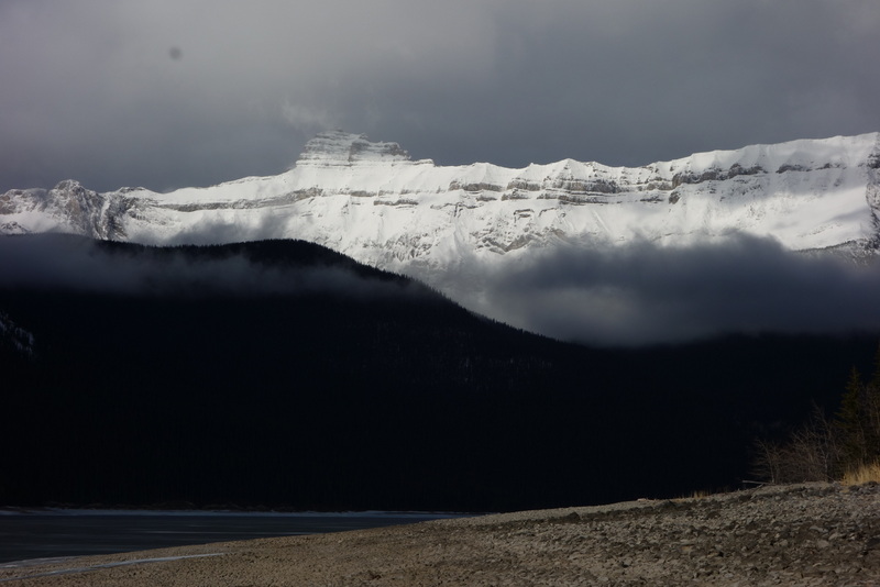
I’m really happy that it’s warming up and spring is on its way. The best thing about spring is that the low-elevation trails in the Rockies are mostly free of snow and the forests are starting to turn a vibrant green. At the end of April I backpacked along Lake Minnewanka, a long reservoir that stretches out to wild Devil’s Gap. All together a journey of 60 km.
Lake Minnewanka
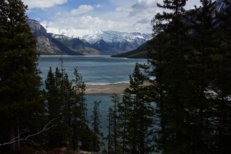
The first thing that struck me when I arrived at the lake is that it was still completely frozen. Even though the air was warm, walking beside a big frozen lake can get chilly. When the wind came up I really felt the cold air.
Still frozen solid
I’ve decided to hike as much as I can in Vibram FiveFingers this year. I really like how you can feel the texture of everything you walk over. It’s a real pleasure when you go from walking on solid rock to soft dirt – something that wouldn’t stand out much in shoes or boots.
Since it’s “spring”, I’ll hike in FiveFingers
It might have been a bit early to put on such minimalist footwear. The trail was quite icy and wet. I found the FiveFingers gripped very well but my feet got cold quickly. As long as I kept moving fast enough, though, they were alright. After a few miles the ice disappeared and the trail was remarkably dry.
Nice dry trail
As soon as I left the lakeside and gained elevation, though, snow appeared and just got deeper and deeper. 500m higher at Aylmer Lookout I was punching through snow up to my waist and struggling to follow the trail. But worth all the effort for amazing views.
View from somewhere near Aylmer Lookout
I made my first camp at the Mount Inglismaldie campground, although I could have camped anywhere along the lake shore. There was no one else around. It’s nice to be alone in nature, especially in an area that gets busy in summer.
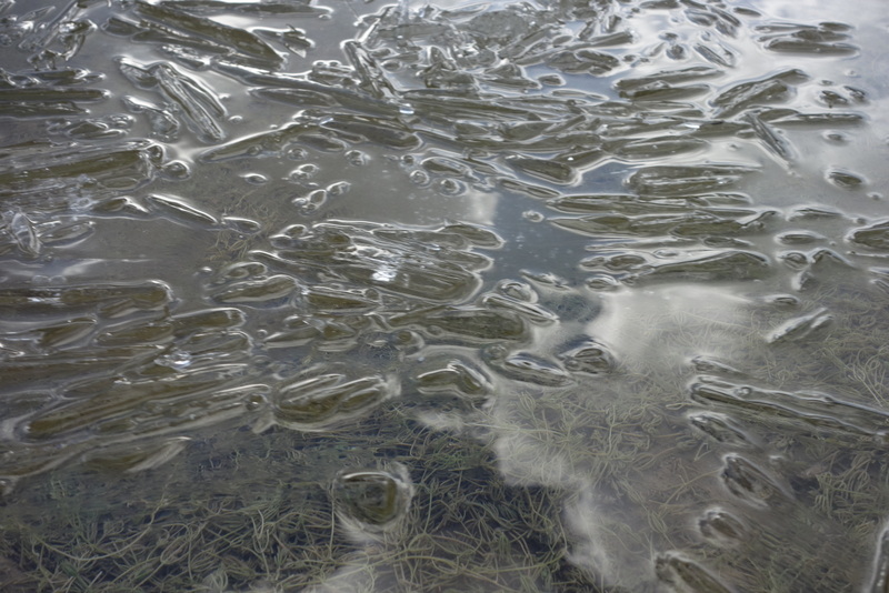
Getting drinking water was an unexpected challenge. In summer there are a number of creeks flowing into the lake but these were all either frozen solid or completely dry. I had to resort to collecting lake water. But even that was a challenge. Only a few places along the shore had thawn out and those usually were separated from the forest by steep slopes of ice. When I did get to the water it was cold!
Ice crystals clink in the water
I woke up to rain on the second day. A light rain that couldn’t decide if it might actually prefer to be snow. Secretly, I love hiking when the weather is nasty – cold, wind blowing rain in your face, feet wet. As long as you have enough chocolate it’s great.
A rainy day
As I came to the end of Lake Minnewanka and continued toward Devil’s Gap the trail got much rougher and the scenery more wild. It’s ironic. You’re walking toward the prairie yet you feel as though you’re moving deeper and deeper into wild mountains.
The trail became less and less distinct, crossing old creek beds, tenderly tiptoeing through moss-covered forest, and eventually disappearing altogether.
I’d like to come back and push all the way through Devil’s Gap to the other side. A summer project, perhaps.
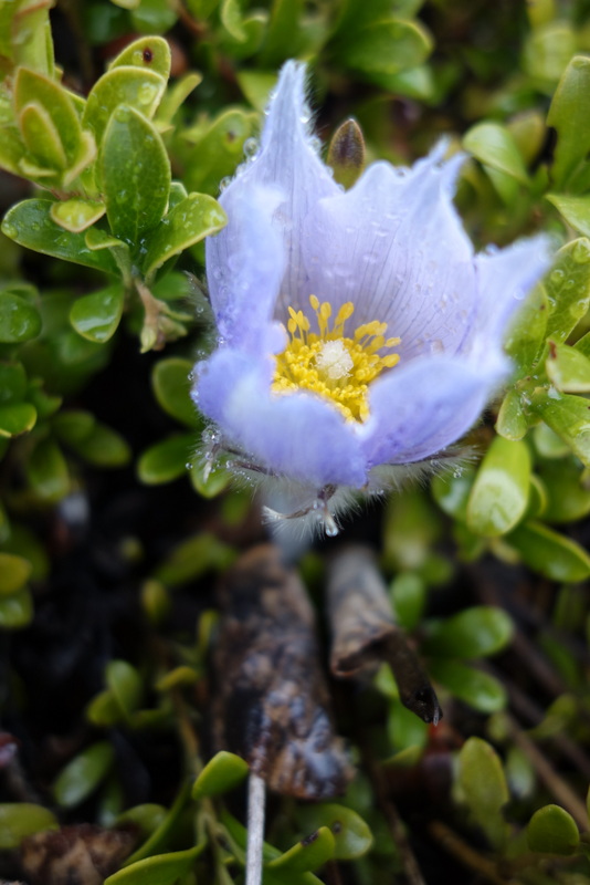
The crocus is my favorite flower
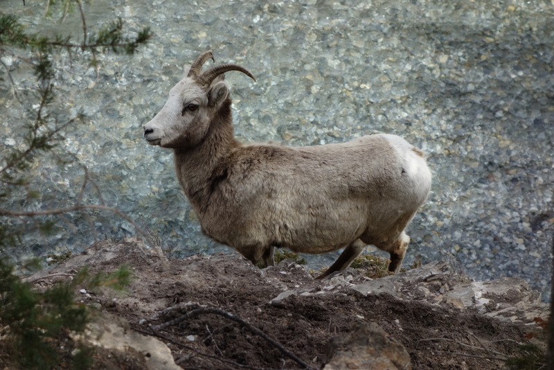
On my way back I encountered this cute little guy, sheepishly standing on a cliff ledge looking up at the trail. Some other hikers told me a large dog had chased him there. Poor guy. And to make it even worse, on the other side of the canyon was another mountain sheep waiting for him – probably his girlfriend!